
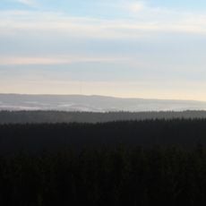
Alf- und Bierbach, protected area in the European Union defined by the habitats directive in Rheinland-Pfalz, Germany
Location: Lünebach
Location: Pronsfeld
Location: Masthorn
Location: Habscheid
Location: Brandscheid
Location: Großlangenfeld
Location: Bleialf
Location: Buchet
Inception: 2003
GPS coordinates: 50.20381,6.29281
Latest update: April 11, 2025 21:29
Schwarzer Mann
7.5 km
Eifel-Zoo
6.2 km
Bleialf transmitter
7.4 km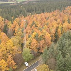
Sender Bleialf
5.1 km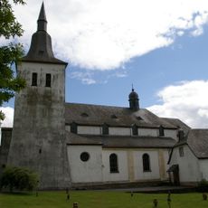
Mariä-Himmelfahrt-Kirche
4 km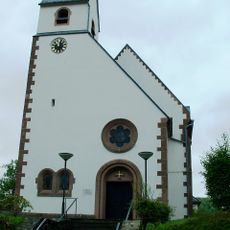
Protestant Church (Pruem)
9.2 km
Saint Remigius Church (Pronsfeld)
6 km
St. Gordian und Epimachus
8.5 km
Alt St. Remigius
6.5 km
St. Michael
5.8 km
St. Laurentius (Großlangenfeld)
3.5 km
Saint Gertrude Church (Lünebach)
8.3 km
Barbarakapelle
4.9 km
St. Hubertus
7.6 km
St. Willibrord
8 km
St. Stephan
6.4 km
St. Kornelius
2.3 km
St. Josef
6 km
St. Maria Magdalena
4.3 km
Der Dulder Job
5.5 km
St. Luzia
2.4 km
St. Isidor
5.7 km
St. Henricus
6.8 km
St. Bartholomäus
5.3 km
St. Hubertus
7.8 km
St. Matthias und Wendelinus
5.6 km
St. Leonhard
5.8 km
St. Barbara
6.8 kmReviews
Visited this place? Tap the stars to rate it and share your experience / photos with the community! Try now! You can cancel it anytime.
Discover hidden gems everywhere you go!
From secret cafés to breathtaking viewpoints, skip the crowded tourist spots and find places that match your style. Our app makes it easy with voice search, smart filtering, route optimization, and insider tips from travelers worldwide. Download now for the complete mobile experience.

A unique approach to discovering new places❞
— Le Figaro
All the places worth exploring❞
— France Info
A tailor-made excursion in just a few clicks❞
— 20 Minutes