LSG-Muensterlaendchen, protected area in Germany
Location: Stolberg
Inception: 2005
GPS coordinates: 50.72246,6.22191
Latest update: November 18, 2025 06:32
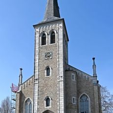
St. Barbara
853 m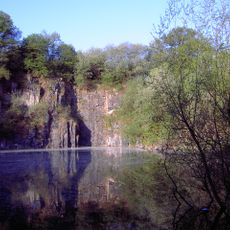
Schomet
170 m
Haus Maria im Venn
1.6 km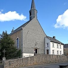
St. Brigida
1.1 km
Ströhbend und Wäldchen nordöstlich von Hahn
1.5 km
Bennebusch und Lindbusch
1.5 km
LSG-Muensterwald
1.5 km
Jammetsbach
943 m
Kriegerdenkmal
904 m
Wayside shrine
943 m
Wayside cross
533 m
Wayside cross
736 m
Wayside cross
1.4 km
Wayside cross
1.6 km
Wilhelm Pitz
1.1 km
Catholic church building, wayside cross, Christianity
542 m
Wayside cross
1.1 km
Work of art, sculpture
991 m
Wayside cross
855 m
Wayside cross
1.1 km
Wayside cross
884 m
Hochkreuz
609 m
Wayside cross
703 m
Wayside cross
729 m
Wayside cross
849 m
Wayside cross
1.4 km
Flutopferkreuz
952 m
Wayside cross
564 mReviews
Visited this place? Tap the stars to rate it and share your experience / photos with the community! Try now! You can cancel it anytime.
Discover hidden gems everywhere you go!
From secret cafés to breathtaking viewpoints, skip the crowded tourist spots and find places that match your style. Our app makes it easy with voice search, smart filtering, route optimization, and insider tips from travelers worldwide. Download now for the complete mobile experience.

A unique approach to discovering new places❞
— Le Figaro
All the places worth exploring❞
— France Info
A tailor-made excursion in just a few clicks❞
— 20 Minutes