LSG-Rurtalhaenge, protected area in Germany
Location: Hürtgenwald
Inception: 2010
GPS coordinates: 50.71677,6.41686
Latest update: November 19, 2025 10:21
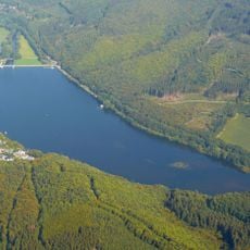
Talsperre Obermaubach
2.1 km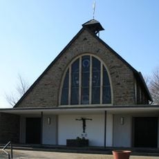
Hürtgenwald-Gedächtnis-Kapelle
1.9 km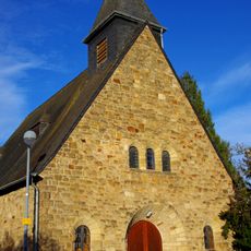
St. Apollinaris
1.9 km
Heimatmuseum Grafschaft Molbach
2.1 km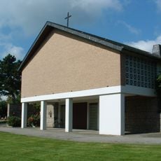
Kapelle Brandenberg
2.1 km
Staubecken Obermaubach einschliesslich Einmündungsbereich der Rur
1.8 km
Rinnebachtal
659 m
Rinnebachtal mit Nebenbächen
659 m
Wayside cross
2 km
Wayside shrine
1.5 km
Scenic viewpoint
1.7 km
Scenic viewpoint
1 km
Christianity, Catholic church building, wayside cross
1.8 km
Wayside cross
1.8 km
Eifelblick Schafsbenden
2.1 km
Wegkreuz
2 km
Winden 1953
1 km
Bench, scenic viewpoint
1.8 km
Wayside shrine
1.5 km
Wayside shrine
1.9 km
Wayside shrine
1.3 km
Memorial, memorial stone
2.1 km
Sandmann
1.6 km
Hauer-Kreuz
1.3 km
Kröz-Kreuz
1.9 km
Glocke
2.1 km
Marienfigur
2.1 km
Memorial
1.8 kmReviews
Visited this place? Tap the stars to rate it and share your experience / photos with the community! Try now! You can cancel it anytime.
Discover hidden gems everywhere you go!
From secret cafés to breathtaking viewpoints, skip the crowded tourist spots and find places that match your style. Our app makes it easy with voice search, smart filtering, route optimization, and insider tips from travelers worldwide. Download now for the complete mobile experience.

A unique approach to discovering new places❞
— Le Figaro
All the places worth exploring❞
— France Info
A tailor-made excursion in just a few clicks❞
— 20 Minutes