
Uferbefestigung Seestraße 6 in Trausnitz
Uferbefestigung Seestraße 6 in Trausnitz, cultural heritage monument D-3-76-173-12 (1) in Trausnitz, Bavaria
Location: Trausnitz
Part of: Pfreimd power station group
Address: Seestraße 6
GPS coordinates: 49.53000,12.28447
Latest update: November 18, 2025 16:27
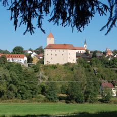
Burg Trausnitz im Tal
1.8 km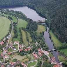
Trausnitz Reservoir
1.3 km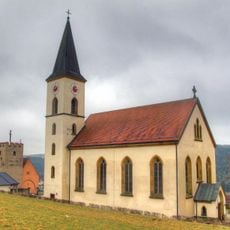
St. Josef
1.6 km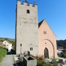
Kapelle Sankt Wenzeslaus, sogenannte Versöhnungskapelle
1.6 km
St. Peter und Paul
615 m
Kapelle
412 m
Lagerhalle Nähe Seestraße in Trausnitz
1.6 km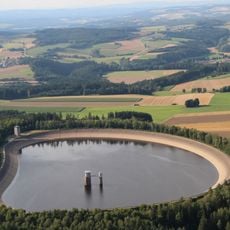
Rabenleite Reservoir
1.3 km
Baudenkmal D-3-76-173-12 in Trausnitz
21 m
Baudenkmal D-3-76-173-13 in Trausnitz
1.5 km
Cultural heritage D-3-6439-0090 in Trausnitz
620 m
Pförtnerhaus Seestraße 6 in Trausnitz
86 m
Friedhofsmauer Hofmarkt 7 in Trausnitz
1.6 km
Pfreimdtal und Kainzbachtal
201 m
Uferbefestigung Nähe Seestraße in Trausnitz
1.5 km
Cultural heritage D-3-6439-0051 in Trausnitz
1.6 km
Wayside shrine
1.8 km
Wayside cross
1.7 km
Wayside shrine
1.5 km
Wayside shrine
1.8 km
Sachsenturm Versöhnungskapelle
1.6 km
Wayside shrine
1.8 km
Wayside cross
1.7 km
Wayside shrine
1.8 km
Wayside cross, Christianity, Catholic church building
1.4 km
Christianity, Catholic church building, wayside cross
741 m
Wayside cross, Christianity, Catholic church building
1.8 km
Kriegerdenkmal
1.6 kmReviews
Visited this place? Tap the stars to rate it and share your experience / photos with the community! Try now! You can cancel it anytime.
Discover hidden gems everywhere you go!
From secret cafés to breathtaking viewpoints, skip the crowded tourist spots and find places that match your style. Our app makes it easy with voice search, smart filtering, route optimization, and insider tips from travelers worldwide. Download now for the complete mobile experience.

A unique approach to discovering new places❞
— Le Figaro
All the places worth exploring❞
— France Info
A tailor-made excursion in just a few clicks❞
— 20 Minutes