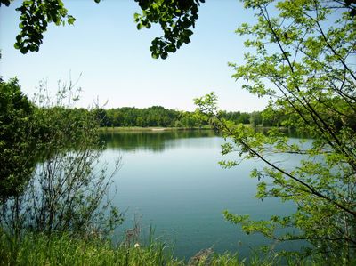
Kaolinsee, Artificial lake in Hohburg, Germany
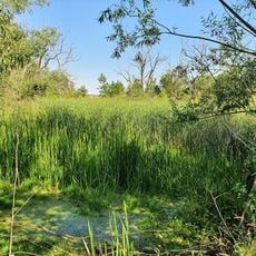
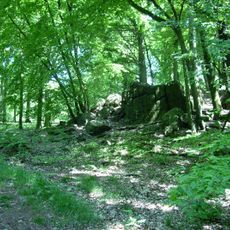
Kaolinsee is an artificial lake in Hohburg formed in a former mining pit, divided into a larger northern section and a smaller southern section connected by a bridge. The shoreline path measures about 1.8 kilometers and provides access to beach areas, forest sections, and designated swimming zones.
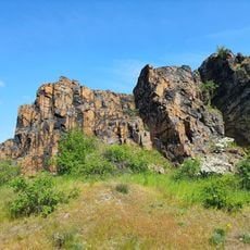
Kaolin mining started in 1901 under Baron Adolf von Schönberg and continued for decades with large-scale extraction operations. After 1964, water gradually filled the abandoned pit, creating the lake that exists today.
Local residents call the water 'de Kali' or 'de Grube' in their regional dialect, keeping the mining past alive in everyday speech. These names reflect how deeply the area's extraction heritage shaped the identity of people here.
Two free parking areas provide convenient access to the lake and surrounding grounds. Designated swimming zones and the well-maintained shoreline path make it easy for visitors of all abilities to enjoy walks and swimming.
Divers explore underwater and discover mining vehicles and equipment left behind when the pit was flooded decades ago. These submerged industrial objects offer a glimpse into the area's extraction past in an unexpected way.
GPS coordinates: 51.40833,12.78767
Latest update: December 14, 2025 18:14
Am Spitzberg
2.9 km
Kleiner Berg Hohburg
700 m
Dorfkirche Zschorna
2.3 km
Lossabrücke
1 km
Kirche Großzschepa
1.7 km
Spitzberg Wurzen
3 km
Eisenbahnstrecke Wurzen–Eilenburg Lüptitz
1.8 km
EÜ Am Bahnhof
910 m
Kirche Hohburg
1.3 km
Lehmgeide Großzschepa
2.5 km
Eisenbahnstrecke Wurzen–Eilenburg Lüptitz
1.5 km
Am Spitzberg
3 km
Eisenbahnbrücke Am Klärwerk
1.2 km
Berge um Hohburg und Dornreichenbach
3 km
Herrenhaus Zschorna
2.4 km
Rittergut Großzschepa (ehemals): mit Herrenhaus, Pferdestall mit Remise und Kutscherwohnung und ehemaliges Turmhaus
1.7 km
Armenhaus Bauerngasse 3
2.3 km
Spritzenhaus Lange Dorfstraße 14 (neben)
2.4 km
Häusleranwesen, bestehend aus Wohnhaus und Scheune Wurzener Straße 14
2.4 km
Denkmal für die Gefallenen des 1. Weltkrieges, Kleinzschepa
769 m
Schloßstraße 13, Rittergut Großzschepa - Wirtschaftsgebäude und ehemaliges Turmhaus
1.8 km
Ehemaliges Armenhaus Lange Dorfstraße 25
2.3 km
Lindenallee 12
1.7 km
Lindenallee 8, Großzschepa
1.7 km
Zschepaer Hauptstraße 18, Großzschepa
2 km
Schloßstraße 6, Großzschepa
1.8 km
Dreiseithof mit Wohnstallhaus, Seitengebäude, Scheune, Hofpflasterung und Einfriedung Bauerngasse 12
2.3 km
Ehemaliger Gasthof mit zwei Seitengebäuden Hohburger Straße 10
2.2 kmVisited this place? Tap the stars to rate it and share your experience / photos with the community! Try now! You can cancel it anytime.
Discover hidden gems everywhere you go!
From secret cafés to breathtaking viewpoints, skip the crowded tourist spots and find places that match your style. Our app makes it easy with voice search, smart filtering, route optimization, and insider tips from travelers worldwide. Download now for the complete mobile experience.
A unique approach to discovering new places❞
— Le Figaro
All the places worth exploring❞
— France Info
A tailor-made excursion in just a few clicks❞
— 20 Minutes