Montauban

Log in to your account

AroundUs is a community-driven map of interesting places, built by curious explorers like you. It grows with every review, story, and photo you share.
Connect to save your favorite spots, contribute locations, and create personalized routes.
Continue with Google
Continue with Apple
Continue with X
Continue with Facebook
Continue with email
By continuing, you accept our Terms and Conditions and our Privacy Policy
Create an account
Add to collection
Map
Suggest a change
Share

Montauban, Administrative center in Tarn-et-Garonne, France

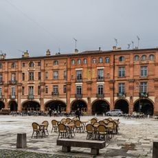
Montauban is a prefecture town in the Tarn-et-Garonne department of southwestern France, positioned on the right bank of the Tarn River. The old town centers around the rectangular Place Nationale, whose 17th-century brick facades and arcaded walkways form the historic core.

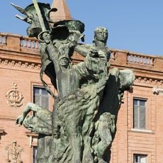
Count Alphonse Jourdain of Toulouse founded the town in 1144 as a fortified bastion, which rapidly grew into an important Protestant stronghold during the Wars of Religion. Royal forces unsuccessfully besieged it in 1621, but after further conflict the town was definitively integrated into the Catholic kingdom in 1629.

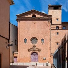
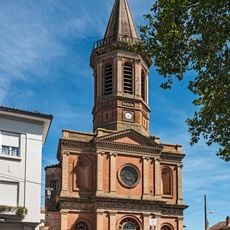
The cathedral of Notre-Dame-de-l'Assomption, completed in 1629, reflects how the town shifted between Catholic and Protestant identities during the religious wars. Locals gather at the Saturday morning market on Place Nationale, where regional produce from Quercy and the surrounding southwestern countryside fills the stalls.

Travelers reach the town easily via motorway A20 or the train station, which offers regular connections to Toulouse and Bordeaux. The historic center is walkable, while the riverside promenade along the Tarn provides a relaxed path outside the old walls.

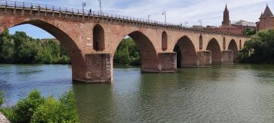
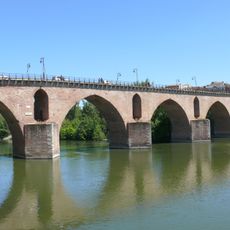
The Pont Vieux was built between 1303 and 1335 and spans the river with seven brick arches, which secured trade and defense for the town for centuries. The bridge still bears visible bullet holes from 17th-century sieges, reminders of its turbulent past.

Location: Tarn-et-Garonne

Location: canton of Montauban-4

Location: canton of Montauban-5

Location: canton of Montauban-6

Location: arrondissement of Montauban

Elevation above the sea: 102 m

Shares border with: L'Honor-de-Cos, Albefeuille-Lagarde, Albias, Bressols, Corbarieu, Labastide-Saint-Pierre, Lacourt-Saint-Pierre, Lamothe-Capdeville, Léojac, Montbeton, Piquecos, Saint-Étienne-de-Tulmont, Saint-Nauphary, Villemade

Address: 82000 Montauban, France

Phone: +33563221200

Email: contact@ville-montauban.fr

Website: http://montauban.com

GPS coordinates: 44.01722,1.35500

Latest update: December 17, 2025 01:23

Photos
Reviews

Visited this place? Tap the stars to rate it and share your experience / photos with the community! Try now! You can cancel it anytime.

« Montauban - Administrative center in Tarn-et-Garonne, France » is provided by Around Us (aroundus.com). Images and texts are derived from Wikimedia project under a Creative Commons license. You are allowed to copy, distribute, and modify copies of this page, under the conditions set by the license, as long as this note is clearly visible.

Discover hidden gems everywhere you go!

From secret cafés to breathtaking viewpoints, skip the crowded tourist spots and find places that match your style. Our app makes it easy with voice search, smart filtering, route optimization, and insider tips from travelers worldwide. Download now for the complete mobile experience.

Around Us App Screenshot

A unique approach to discovering new places

Le Figaro

All the places worth exploring

France Info

A tailor-made excursion in just a few clicks

20 Minutes