Enable Location

We need your location to show you interesting places around you

Discover nearby places

Find interesting locations and hidden gems around you

Precise directions

Get accurate directions and distances to places

Your location is never shared with other users. It's only used when you tap the location button.

Montlhéry

Log in to your account

Start exploring — it's free

Trusted by 62,127 travelers worldwide

Continue with Google
Continue with Apple
or

We will send you a code to connect

By continuing, you accept our Terms and Conditions and our Privacy Policy

Check your inbox

We've sent a pincode in your inbox. Please enter the code below.

Montlhéry, Administrative commune in Essonne, France

Montlhéry is a commune in the Essonne department, located roughly 26 kilometers south of Paris. The town contains residential areas, public facilities, and a castle that shapes the local landscape.

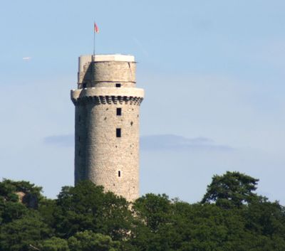
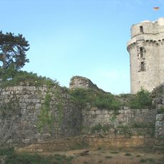
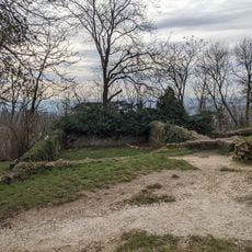
The commune developed as a strategic settlement along the Paris-Orléans road, a vital trade route. In the early 13th century, the castle here was reconstructed and strengthened under King Philip II.

The town maintains a sister relationship with the German municipality Stetten am kalten Markt, fostering regular exchanges between residents. This partnership shapes how people in both communities connect and understand each other.

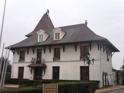
The town hall is located on rue Blanche de Castille and serves visitors on weekdays and Saturday mornings. This is where to find municipal services and local information when you need assistance.

Scientist François Arago conducted speed of sound experiments from the castle tower in 1822 by using cannon shots as measuring points. These early scientific measurements turned the location into a site of significant physics research.

The community of curious travelers

AroundUs brings together thousands of curated places, local tips, and hidden gems, enriched daily by 60,000 contributors worldwide.

Start exploring
Location
Elevation above the sea
104 m
Shares border with
Nozay, Linas, Longpont-sur-Orge, Marcoussis, La Ville-du-Bois
Phone
GPS coordinates
48.63861,2.27222
Latest update
December 13, 2025 15:14
« Montlhéry - Administrative commune in Essonne, France » is provided by Around Us (aroundus.com). Images and texts are derived from Wikimedia project under a Creative Commons license. You are allowed to copy, distribute, and modify copies of this page, under the conditions set by the license, as long as this note is clearly visible.

Discover hidden gems everywhere you go!

From secret cafés to breathtaking viewpoints, skip the crowded tourist spots and find places that match your style. Our app makes it easy with voice search, smart filtering, route optimization, and insider tips from travelers worldwide. Download now for the complete mobile experience.

Around Us App Screenshot

A unique approach to discovering new places

Le Figaro

All the places worth exploring

France Info

A tailor-made excursion in just a few clicks

20 Minutes

Around Us
Travel Guide & Maps
Download

Send to your phone

QR Code
1

Open the camera app on your mobile.

2

Point at the QR code with your camera. A notification will appear.

3

Tap the notification to open the link.