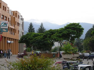
Lavelanet, Administrative center in Ariège, France
Lavelanet is a French commune in the Occitanie region, situated at 525 meters elevation in the Pamiers arrondissement. It serves as an administrative hub for around 6,000 residents and contains public facilities including schools and medical services.
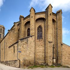
Settlement here dates to Roman times, with archaeological evidence showing continuous occupation through the medieval period and into modern times. This long habitation shaped the area's development into the present day.
Residents celebrate Occitan traditions through festivals featuring regional music, dance, and local food throughout the year. These gatherings bring the community together and reflect the area's deep roots in regional culture.
The town offers basic facilities including schools, medical practices, and administrative services for visitors and residents. Its location at 525 meters elevation provides good access to the surrounding countryside and neighboring towns.
The name comes from the Latin word 'avellana,' referring to hazel nuts that once grew abundantly in the surrounding area. This connection to local plants shows how nature influenced the area's naming.
Location: arrondissement of Pamiers
Elevation above the sea: 572 m
Shares border with: Bénaix, Dreuilhe, Laroque-d'Olmes, Péreille, Raissac, Saint-Jean-d'Aigues-Vives, Sautel, Villeneuve-d'Olmes
Phone: +33561015370
Email: lavelanet@wanadoo.fr
Website: http://mairie-lavelanet.fr
GPS coordinates: 42.93278,1.84861
Latest update: December 20, 2025 02:16
Musée du textile et du peigne en corne de Lavelanet
438 m
Église du Saint-Sacrement de Laroque-d'Olmes
4.7 km
Chapelle Saint-Sernin de Bensa
586 m
Église Saint-Vincent de Péreille
4 km
Église Notre-Dame-de-l'Assomption de Lavelanet
305 m
Église de la Décollation-de-Saint-Jean-Baptiste de Saint-Jean-d'Aigues-Vives
2.1 km
Église Notre-Dame-de-l'Assomption de Raissac
3.1 km
Église Notre-Dame-de-l'Assomption de Villeneuve-d'Olmes
3.5 kmOrgue de tribune de l'église Notre-Dame-de-l'Assomption de Lavelanet
305 mCap de la Mounjo
3.5 kmScenic viewpoint
4.7 kmScenic viewpoint
411 mScenic viewpoint
4.7 kmScenic viewpoint
4.5 kmScenic viewpoint
384 mScenic viewpoint
305 mScenic viewpoint
3.6 kmCalvaire
306 mScenic viewpoint, toposcope
4.1 kmWayside cross
216 mMemorial, war memorial
3.1 kmRuins
2.8 kmRuines du Château féodal de Lavelanet
419 mRuins
4.6 kmStele, memorial
3 kmCroix de Morenci
4.5 kmCatholic church building, wayside cross
3.8 kmVisited this place? Tap the stars to rate it and share your experience / photos with the community! Try now! You can cancel it anytime.
Discover hidden gems everywhere you go!
From secret cafés to breathtaking viewpoints, skip the crowded tourist spots and find places that match your style. Our app makes it easy with voice search, smart filtering, route optimization, and insider tips from travelers worldwide. Download now for the complete mobile experience.
A unique approach to discovering new places❞
— Le Figaro
All the places worth exploring❞
— France Info
A tailor-made excursion in just a few clicks❞
— 20 Minutes