Étang du Stock, lake in France
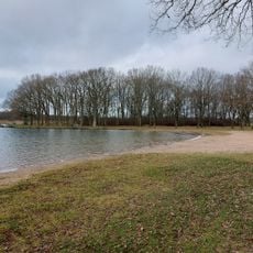
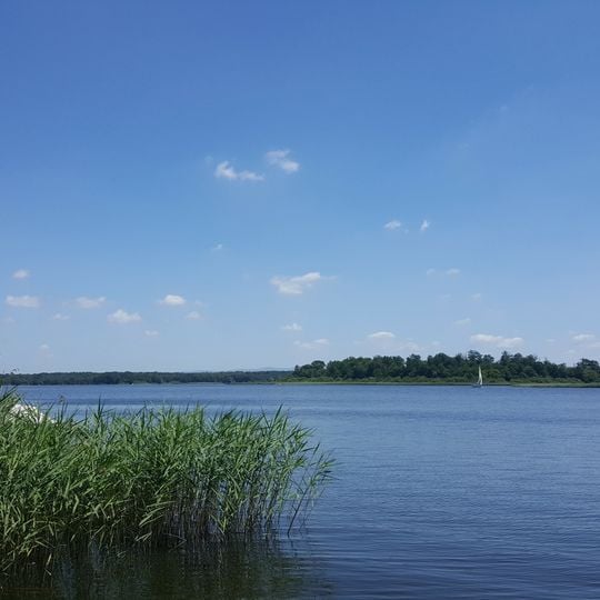
The Étang du Stock is a reservoir of 700 to 750 hectares in the Moselle department, at an altitude of 257 metres. The canal des Houillères de la Sarre crosses it on an embankment that divides the water into a main western part and the smaller Étang des Femmes to the east; a culvert near Les-Trois-Ponts lets water pass between the two. It lies in the Pays des étangs, with Rhodes on the western shore.
The pond is documented as Stockweyer in 1558 and as Estang de la Tour on a 1696 map, when a fortified tower, the Tour-du-Stock, stood guard over it. Around 1900 it covered about 360 hectares. In the 1930s it was raised to supply the Maginot Line's water defences, and since 1920 it has fed the Saar coal canal, reaching roughly 18 million m³.
The pond's name appears as Stockweyer in 1558 and as Estang de la Tour on a 1696 map, recalling the fortified Tour-du-Stock that once defended it. Today sailing clubs based at the site run sailing courses for children and teenagers, and the water is used for boating and fishing.
The lake is managed by Voies navigables de France and is not fully drainable; water levels are lowered only about every five years for maintenance of the structures. The Sarre coal canal crosses the lake on an embankment, splitting it into a main western part and the small eastern Étang des Femmes, linked by a culvert near Les-Trois-Ponts. Sailing and motor boating are practised, and local sailing clubs run courses for children and teenagers.
The reservoir was formed by a low earth dam that flooded and connected older ponds; their sites survive as "cornées", the local name for these former pond beds. The water level is not fully drained and is lowered only about every five years for maintenance.
The community of curious travelers
AroundUs brings together thousands of curated places, local tips, and hidden gems, enriched daily by 94,004 contributors worldwide.