Enable Location

We need your location to show you interesting places around you

Discover nearby places

Find interesting locations and hidden gems around you

Precise directions

Get accurate directions and distances to places

Your location is never shared with other users. It's only used when you tap the location button.

Lannemezan

Log in to your account

Start exploring — it's free

Trusted by 61,919 travelers worldwide

Continue with Google
Continue with Apple
or

We will send you a code to connect

By continuing, you accept our Terms and Conditions and our Privacy Policy

Check your inbox

We've sent a pincode in your inbox. Please enter the code below.

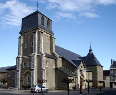
Lannemezan, Administrative commune in Hautes-Pyrénées, France

Lannemezan is a commune in the Hautes-Pyrénées region of southwestern France, positioned on an elevated plateau. The town functions as a regional center with administrative services and transportation connections serving the surrounding rural areas.

The commune originated in the 13th century when a fortified settlement was established at this strategic location. Its position between major trade routes shaped its development as a regional hub.

The weekly market brings together local producers and residents in a gathering that shows regional customs and traditions. Visitors can see how the community shares goods and maintains connections through this regular gathering.

The railway station serves as a key transportation hub connecting the town to surrounding areas. Exploring local bus routes helps visitors reach nearby villages and attractions in the region.

The local economy relies heavily on public sector employment, which accounts for the majority of jobs in the area. This employment pattern sets the town apart from many other rural communities in the region.

The community of curious travelers

AroundUs brings together thousands of curated places, local tips, and hidden gems, enriched daily by 60,000 contributors worldwide.

Start exploring
Elevation above the sea
585 m
Shares border with
Avezac-Prat-Lahitte, La Barthe-de-Neste, Campistrous, Capvern, Clarens, Escala, Pinas, Uglas, Cantaous, Galez
Address
65300 Lannemezan, France
Phone
GPS coordinates
43.12389,0.38472
Latest update
December 19, 2025 22:52
« Lannemezan - Administrative commune in Hautes-Pyrénées, France » is provided by Around Us (aroundus.com). Images and texts are derived from Wikimedia project under a Creative Commons license. You are allowed to copy, distribute, and modify copies of this page, under the conditions set by the license, as long as this note is clearly visible.

Discover hidden gems everywhere you go!

From secret cafés to breathtaking viewpoints, skip the crowded tourist spots and find places that match your style. Our app makes it easy with voice search, smart filtering, route optimization, and insider tips from travelers worldwide. Download now for the complete mobile experience.

Around Us App Screenshot

A unique approach to discovering new places

Le Figaro

All the places worth exploring

France Info

A tailor-made excursion in just a few clicks

20 Minutes

Around Us
Travel Guide & Maps
Download

Send to your phone

QR Code
1

Open the camera app on your mobile.

2

Point at the QR code with your camera. A notification will appear.

3

Tap the notification to open the link.