Cap de la Chèvre, Maritime headland in Crozon Peninsula, France.
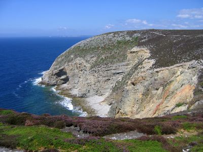
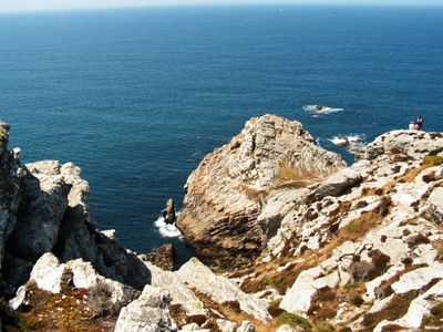
Cap de la Chèvre is a headland on the Crozon Peninsula that rises steeply into the Atlantic, featuring dramatic rock formations reaching several dozen meters above water. The cape forms a natural boundary with distinct sections that visitors can explore to find different viewpoints.
The cape took shape over millennia as the coastline evolved during the formation of Brittany. During World War II, military structures were built here to monitor Atlantic shipping routes.
The name comes from Breton 'Beg ar C'hawr', referring to a giant from Celtic mythology connected to this coastline. Local residents still share this tale as part of how they understand their bond to this place.
The GR34 hiking trail is the main way to reach the cape, connecting several viewpoints overlooking Sein and Ouessant Islands. Plan for uneven terrain and watch the tides, as they affect access to certain areas.
The waters around the cape feature sand formations called 'baïnes' that create strong currents when tides change. These natural phenomena make the water unpredictable and demand caution from swimmers.
The community of curious travelers
AroundUs brings together thousands of curated places, local tips, and hidden gems, enriched daily by 60,000 contributors worldwide.