Enable Location

We need your location to show you interesting places around you

Discover nearby places

Find interesting locations and hidden gems around you

Precise directions

Get accurate directions and distances to places

Your location is never shared with other users. It's only used when you tap the location button.

Rive-de-Gier

Log in to your account

Start exploring — it's free

Trusted by 63,932 travelers worldwide

Continue with Google
Continue with Apple
or

We will send you a code to connect

By continuing, you accept our Terms and Conditions and our Privacy Policy

Check your inbox

We've sent a pincode in your inbox. Please enter the code below.

Discussion Reviews 1 Photos
20.9k Popularity

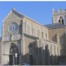
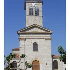
Rive-de-Gier, commune in Loire, France

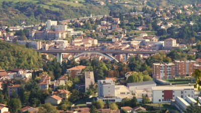
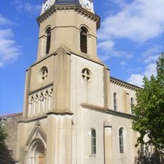
Rive-de-Gier is a town in the Loire region near Saint-Étienne, situated on varying elevations from about 745 feet (227 meters) to nearly 1,300 feet (400 meters). Its layout combines an older town center with residential areas and preserved industrial buildings that reflect its past as a mining and factory hub.

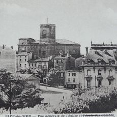
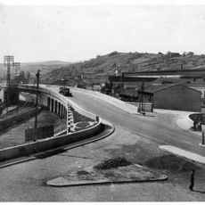
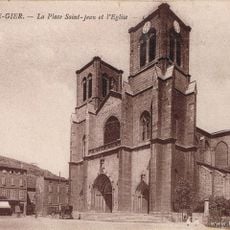
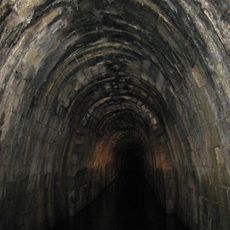
The town emerged in the 11th century on the Gier riverbanks and was originally protected by walls. It transformed during the industrial period from the 17th century onward when coal mining and factories drove expansion. A canal opened in 1779 connecting to Lyon and beyond, and France's first railway tunnel was built here, marking its importance to national transportation networks.

Rive-de-Gier takes its name from its location on the bank of the Gier River, a connection that shapes how people relate to the town today. The community maintains strong ties to its working-class heritage through markets on Tuesday and Saturday, cultural festivals, and sports events that bring residents together and reinforce shared values of hard work and cooperation.

The town is best explored on foot, with good views from surrounding hills. The nearby Pilat Regional Natural Park offers hiking trails and outdoor activities, while the A47 highway provides easy access by car, making it convenient to explore the Vallée du Gier valley and nearby villages like Saint-Romain-en-Jarez and Valla-en-Gier.

The town was home to France's first railway tunnel, marking a watershed moment in national transportation. This engineering feat made Rive-de-Gier a center of transport innovation and gave it lasting importance in France's industrial story that visitors walking through often overlook.

The community of curious travelers

AroundUs brings together thousands of curated places, local tips, and hidden gems, enriched daily by 60,000 contributors worldwide.

Start exploring
Location
Elevation above the sea
294 m
Shares border with
Saint-Martin-la-Plaine, Châteauneuf, Farnay, Lorette, Genilac, Saint-Joseph, Chabanière
Phone
GPS coordinates
45.52944,4.61694
Latest update
February 7, 2026 09:31
Reviews
Share your experience

No review yet

Discussions
Start a discussion...

No discussion yet

« Rive-de-Gier - commune in Loire, France » is provided by Around Us (aroundus.com). Images and texts are derived from Wikimedia project under a Creative Commons license. You are allowed to copy, distribute, and modify copies of this page, under the conditions set by the license, as long as this note is clearly visible.

Discover hidden gems everywhere you go!

From secret cafés to breathtaking viewpoints, skip the crowded tourist spots and find places that match your style. Our app makes it easy with voice search, smart filtering, route optimization, and insider tips from travelers worldwide. Download now for the complete mobile experience.

Around Us App Screenshot

A unique approach to discovering new places

Le Figaro

All the places worth exploring

France Info

A tailor-made excursion in just a few clicks

20 Minutes

Around Us
Travel Guide & Maps
Download

Send to your phone

QR Code
1

Open the camera app on your mobile.

2

Point at the QR code with your camera. A notification will appear.

3

Tap the notification to open the link.