Richelieu

Log in to your account

AroundUs is a community-driven map of interesting places, built by curious explorers like you. It grows with every review, story, and photo you share.
Connect to save your favorite spots, contribute locations, and create personalized routes.
By continuing, you accept our Terms and Conditions and our Privacy Policy
Add to collection
Map
Suggest a change
Share

Richelieu, Planned commune in Indre-et-Loire, France.

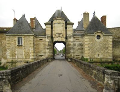
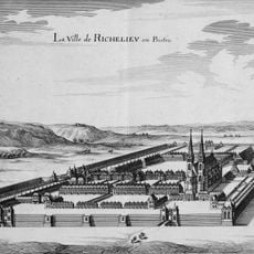
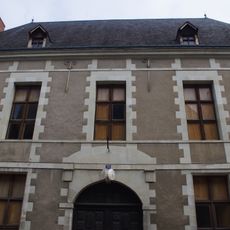
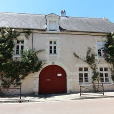
Richelieu is a planned town in Indre-et-Loire with a geometric layout centered on two main squares connected by straight streets running in an organized grid pattern. The entire settlement was originally surrounded by defensive walls that clearly defined the boundaries of the urban design.

The town was built between 1631 and 1642 by architect Jacques Lemercier under the direction of Cardinal Richelieu as a demonstration of planned urban design. This ambitious project was intended to showcase how modern town planning and order could be achieved under centralized authority.

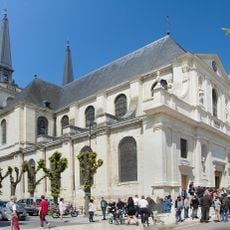
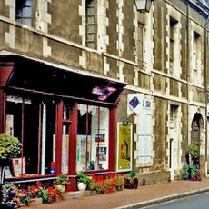
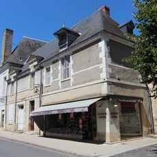
The two central squares served as gathering places and remain where locals and visitors walk through shaded arcades to experience the planned layout firsthand. The residential buildings display consistent architectural styling that reflects the original vision for organized community life.

The visitor center offers information about the town layout and history to help guests explore the streets on their own. The paved squares and walkways are easy to navigate on foot, with all main sights located along the primary axes of the grid.

Each month, owners of classic cars and motorcycles gather to drive their vehicles through the geometric streets of town. These regular meetings bring contemporary activity to the historic street layout and attract enthusiasts from the surrounding region.

Location: canton of Richelieu

Location: Indre-et-Loire

Location: arrondissement of Chinon

Architects: Jacques Lemercier

Elevation above the sea: 59 m

Shares border with: Braye-sous-Faye, Champigny-sur-Veude, Chaveignes, Pouant

Phone: +33247581013

Email: mairie@ville-richelieu.fr

Website: http://ville-richelieu.fr

GPS coordinates: 47.01417,0.32361

Latest update: December 6, 2025 22:04

Photos
Reviews

Visited this place? Tap the stars to rate it and share your experience / photos with the community! Try now! You can cancel it anytime.

« Richelieu - Planned commune in Indre-et-Loire, France » is provided by Around Us (aroundus.com). Images and texts are derived from Wikimedia project under a Creative Commons license. You are allowed to copy, distribute, and modify copies of this page, under the conditions set by the license, as long as this note is clearly visible.

Discover hidden gems everywhere you go!

From secret cafés to breathtaking viewpoints, skip the crowded tourist spots and find places that match your style. Our app makes it easy with voice search, smart filtering, route optimization, and insider tips from travelers worldwide. Download now for the complete mobile experience.

Around Us App Screenshot

A unique approach to discovering new places

Le Figaro

All the places worth exploring

France Info

A tailor-made excursion in just a few clicks

20 Minutes