Enable Location

We need your location to show you interesting places around you

Discover nearby places

Find interesting locations and hidden gems around you

Precise directions

Get accurate directions and distances to places

Your location is never shared with other users. It's only used when you tap the location button.

Saint-Affrique

Log in to your account

Start exploring — it's free

Trusted by 67,569 travelers worldwide

Continue with Google
Continue with Apple
or

We will send you a code to connect

By continuing, you accept our Terms and Conditions and our Privacy Policy

Check your inbox

We've sent a pincode in your inbox. Please enter the code below.

Discussion Reviews 5 Photos
56.5k Popularity

Saint-Affrique, Administrative commune in Aveyron, France.

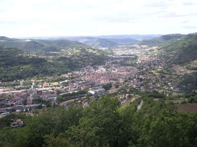
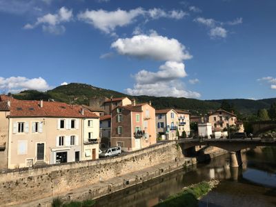
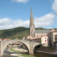
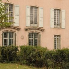
Saint-Affrique is a commune in the Aveyron department of southern France, sitting between the Dourdou de Camarès river and the Sorgues river at 330 meters elevation. The settlement spreads across gentle hills with residential neighborhoods, small squares, and a central main street connecting both riverbanks.

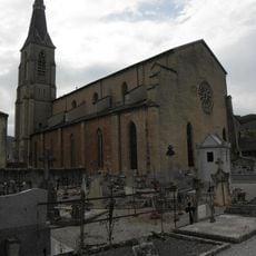
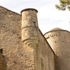
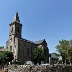
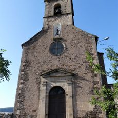
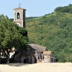
A settlement formed here in the 6th century around the tomb of Saint Africain, which attracted pilgrims. Later, local lords built a fortress on the Caylus rock to control the valley.

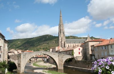
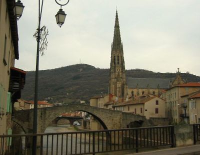
The town connects the Dourdou and the Sorgues through old stone bridges that still carry daily traffic. Local weekly markets bring farmers from the hills together, who spread out cheese and regional products under plane trees.

The town hall in the center offers public services and a media library that visitors can use. Regular markets and community events take place throughout the year, usually on weekends or public holidays.

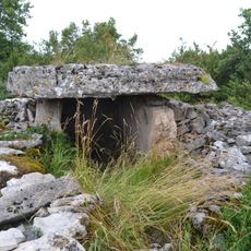
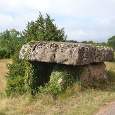
The dolmen of Tiergues near the Caylus rock is a large megalithic structure from the Neolithic period. Locals sometimes use the site for quiet walks away from the main roads.

The community of curious travelers

AroundUs brings together thousands of curated places, local tips, and hidden gems, enriched daily by 60,000 contributors worldwide.

Start exploring
Location
Location
arrondissement of Millau
Elevation above the sea
503 m
Shares border with
Calmels-et-le-Viala, Les Costes-Gozon, Gissac, Roquefort-sur-Soulzon, Saint-Jean-d'Alcapiès, Saint-Jean-et-Saint-Paul, Saint-Rome-de-Cernon, Saint-Rome-de-Tarn, Vabres-l'Abbaye, Versols-et-Lapeyre
Address
12400 Saint-Affrique, France
Phone
GPS coordinates
43.95833,2.88639
Latest update
December 13, 2025 19:56
Reviews
Share your experience

No review yet

Discussions
Start a discussion...

No discussion yet

« Saint-Affrique - Administrative commune in Aveyron, France » is provided by Around Us (aroundus.com). Images and texts are derived from Wikimedia project under a Creative Commons license. You are allowed to copy, distribute, and modify copies of this page, under the conditions set by the license, as long as this note is clearly visible.

Discover hidden gems everywhere you go!

From secret cafés to breathtaking viewpoints, skip the crowded tourist spots and find places that match your style. Our app makes it easy with voice search, smart filtering, route optimization, and insider tips from travelers worldwide. Download now for the complete mobile experience.

Around Us App Screenshot

A unique approach to discovering new places

Le Figaro

All the places worth exploring

France Info

A tailor-made excursion in just a few clicks

20 Minutes

Around Us
Travel Guide & Maps
Download

Send to your phone

QR Code
1

Open the camera app on your mobile.

2

Point at the QR code with your camera. A notification will appear.

3

Tap the notification to open the link.