Château de Pierre-Percée, Medieval castle ruins in Pierre-Percée, France.
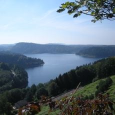
Château de Pierre-Percée stands at 495 m on a 120 m-long sandstone and pudding-stone ridge in the Vosges foothills, east of Badonviller. Only modest walls remain at the south-west end, including a square keep 8 × 8 m that still rises 13 m. The lower courtyard lay on the gentler north-west slope, and the village below was built with stones from the castle.
A chronicle of around 1140 names Albert of Longuicastro, latinised from Langenstein, a noble of the mid-11th century; the castle was probably built by Albert, duke of Lorraine, killed in 1048 at Thuin. Around 1135 the bishop of Metz, Stephen of Bar, besieged it and the garrison held out for a year. In the Thirty Years' War the deserted castle was destroyed during the 1636 siege by troops under Bernard of Saxe-Weimar.
The name Pierre-Percée comes from a well about 33 metres deep cut into the rock, traditionally attributed to Agnes of Bar before 1138. Latin sources called the fortress Petrae Perforatae and old French Piereperciée, while the owners kept the title Counts of Langenstein. Only the upper part of the well, 2.20 metres in diameter, is still visible.
The site is accessible on foot, but the paths to the summit are steep and require decent footwear and some stamina. Plan extra time for the climb and bring water with you, as there are no facilities on the hilltop.
The castle's name comes from a well about 33 metres deep, dug into the rock before 1138 on the initiative of Agnès, widow of the count of Langenstein. Only the upper shaft, 2.20 metres across, is still visible. The feat gave the fortress the Latin name Petrae Perforatae and the village its name.
The community of curious travelers
AroundUs brings together thousands of curated places, local tips, and hidden gems, enriched daily by 94,049 contributors worldwide.