·

Enable Location

We need your location to show you interesting places around you

Discover nearby places

Find interesting locations and hidden gems around you

Precise directions

Get accurate directions and distances to places

Your location is never shared with other users. It's only used when you tap the location button.

Mortagne-sur-Sèvre

Log in to your account

Start exploring — it's free

Trusted by 62,654 travelers worldwide

Continue with Google
Continue with Apple
or

We will send you a code to connect

By continuing, you accept our Terms and Conditions and our Privacy Policy

Check your inbox

We've sent a pincode in your inbox. Please enter the code below.

Mortagne-sur-Sèvre

Mortagne-sur-Sèvre, Commune in Vendée department, Pays de la Loire region, France.

Mortagne-sur-Sèvre spans approximately 121.94 square kilometers across varying terrain from 57 to 151 meters elevation, supporting over 6,000 residents in western France.

The commune was established in 1964 through the administrative merger of three separate localities: Mortagne-sur-Sèvre, Évrunes, and Saint-Hilaire-de-Mortagne to streamline governance.

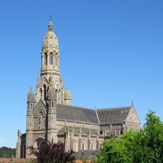
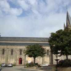
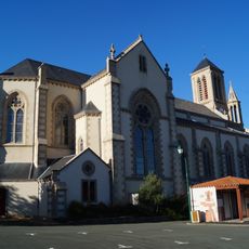
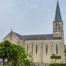
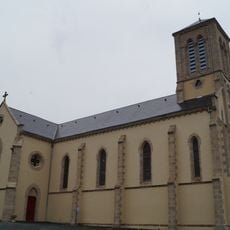
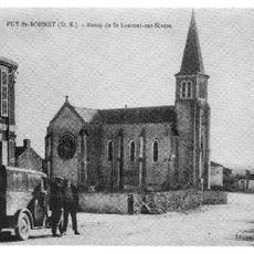
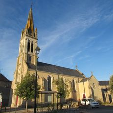
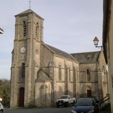
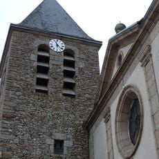
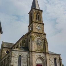
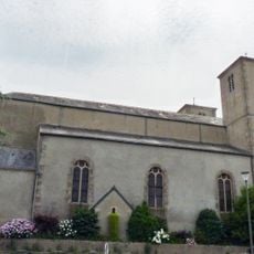
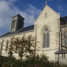
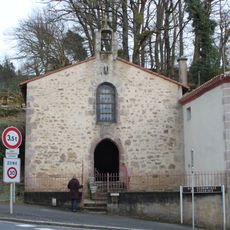
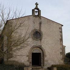
The village of Évrunes within the commune features a historical church that serves as a cultural landmark reflecting the community's religious heritage and architectural traditions.

Located at coordinates 46°59′33″N 0°57′09″W with postal code 85290, the commune is governed by Mayor Alain Brochoire serving from 2020 to 2026.

The population has grown consistently from 4,246 residents in 1968 to over 6,065 in 2022, representing a density of approximately 280 inhabitants per square kilometer.

The community of curious travelers

AroundUs brings together thousands of curated places, local tips, and hidden gems, enriched daily by 60,000 contributors worldwide.

Start exploring
Location
Industry
administration publique générale
Shares border with
Cholet, Le Longeron, Saint-Christophe-du-Bois, Mauléon, Saint-Aubin-des-Ormeaux, Saint-Laurent-sur-Sèvre, La Verrie, Chanverrie
Address
85290 Mortagne-sur-Sèvre, France
Phone
GPS coordinates
46.99167,-0.95389
Latest update
August 17, 2025 15:17
Around this place
Viaduc de Barbin
France

Viaduc de Barbin

3.9 km
La Meilleraie
France

La Meilleraie

8.6 km
Musée du textile de Cholet
France

Musée du textile de Cholet

9.5 km
France

Château de Mortagne-sur-Sèvre

423 m
Basilica of St. Louis de Montfort
France

Basilica of St. Louis de Montfort

6.1 km
France

Musée d'Art et d'Histoire de Cholet

9.3 km
Tour du Grenier à sel
France

Tour du Grenier à sel

9.5 km
France

Église Notre-Dame de La Séguinière

7.9 km
Église Notre-Dame-de-la-Nativité de Chambretaud
France

Église Notre-Dame-de-la-Nativité de Chambretaud

7.8 km
Église Saint-Pierre de Mortagne-sur-Sèvre
France

Église Saint-Pierre de Mortagne-sur-Sèvre

71 m
Église Saint-Maixent de La Verrie
France

Église Saint-Maixent de La Verrie

4.7 km
Église Saint-Christophe de Saint-Christophe-du-Bois
France

Église Saint-Christophe de Saint-Christophe-du-Bois

4.1 km
Église Saint-Malo de Saint-Malô-du-Bois
France

Église Saint-Malo de Saint-Malô-du-Bois

8 km
Église Saint-Emmeran du Puy-Saint-Bonnet
France

Église Saint-Emmeran du Puy-Saint-Bonnet

4.7 km
Église Saint-Louis-Marie-Grignion-de-Montfort de Cholet
France

Église Saint-Louis-Marie-Grignion-de-Montfort de Cholet

8.3 km
Église Saint-André de Loublande
France

Église Saint-André de Loublande

8.8 km
Église Notre-Dame-de-l'Assomption d'Évrunes
France

Église Notre-Dame-de-l'Assomption d'Évrunes

1.7 km
Église Notre-Dame-des-Lacs de La Tessoualle
France

Église Notre-Dame-des-Lacs de La Tessoualle

7.9 km
Église Notre-Dame du Longeron
France

Église Notre-Dame du Longeron

8.6 km
Chapelle Notre-Dame-de-Lourdes de Chambretaud
France

Chapelle Notre-Dame-de-Lourdes de Chambretaud

7.9 km
Église Saint-Romain de La Romagne
France

Église Saint-Romain de La Romagne

9.3 km
Église Saint-Aubin de Saint-Aubin-des-Ormeaux
France

Église Saint-Aubin de Saint-Aubin-des-Ormeaux

6.8 km
Chapelle Saint-Joseph des Sœurs de la Sagesse de Saint-Laurent-sur-Sèvre
France

Chapelle Saint-Joseph des Sœurs de la Sagesse de Saint-Laurent-sur-Sèvre

6.2 km
Chapelle Saint-Gabriel de Saint-Laurent-sur-Sèvre
France

Chapelle Saint-Gabriel de Saint-Laurent-sur-Sèvre

5.9 km
Chapelle de la Sagesse de Saint-Laurent-sur-Sèvre
France

Chapelle de la Sagesse de Saint-Laurent-sur-Sèvre

6.2 km
Chapelle de la Passion, au Calvaire de Saint-Laurent-sur-Sèvre
France

Chapelle de la Passion, au Calvaire de Saint-Laurent-sur-Sèvre

5.7 km
Chapelle Notre-Dame-de-l'Assomption du Pont
France

Chapelle Notre-Dame-de-l'Assomption du Pont

660 m
Chapelle Saint-Lazare de Mortagne-sur-Sèvre
France

Chapelle Saint-Lazare de Mortagne-sur-Sèvre

759 m
Show the full map
« Mortagne-sur-Sèvre - Commune in Vendée department, Pays de la Loire region, France » is provided by Around Us (aroundus.com). Images and texts are derived from Wikimedia project under a Creative Commons license. You are allowed to copy, distribute, and modify copies of this page, under the conditions set by the license, as long as this note is clearly visible.

Discover hidden gems everywhere you go!

From secret cafés to breathtaking viewpoints, skip the crowded tourist spots and find places that match your style. Our app makes it easy with voice search, smart filtering, route optimization, and insider tips from travelers worldwide. Download now for the complete mobile experience.

Around Us App Screenshot

A unique approach to discovering new places

Le Figaro

All the places worth exploring

France Info

A tailor-made excursion in just a few clicks

20 Minutes

Around Us
Travel Guide & Maps
Download

Send to your phone

QR Code
1

Open the camera app on your mobile.

2

Point at the QR code with your camera. A notification will appear.

3

Tap the notification to open the link.