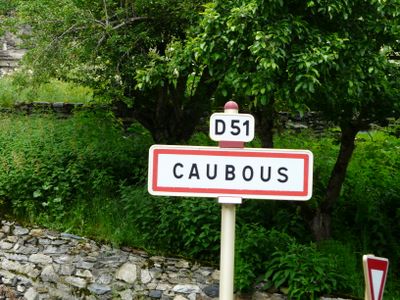
Caubous, commune in Haute-Garonne, France
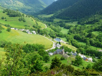
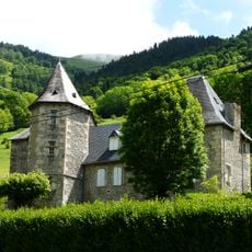
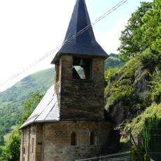
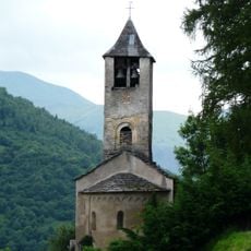
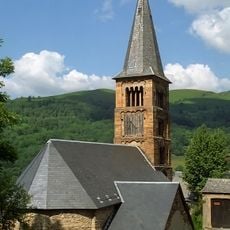
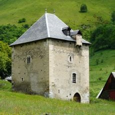
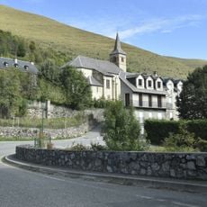
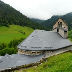
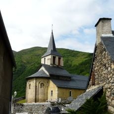
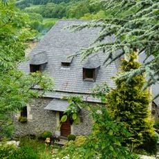
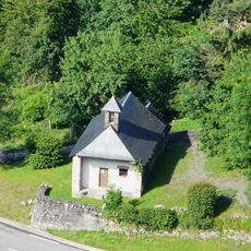
Caubous is a very small village in the Luchonnais valley in the Pyrenees at around 1,200 feet (400 meters) elevation, surrounded by forests and mountain meadows. The settlement consists of just a few stone houses with slate roofs scattered across the landscape, with the Neste d'Oueil stream flowing through the area.
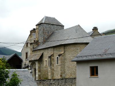
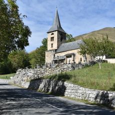
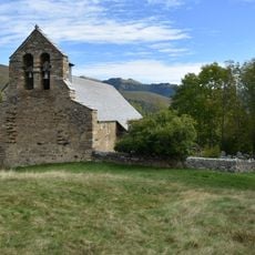
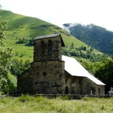
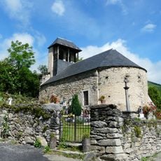
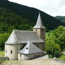
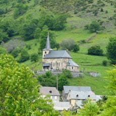
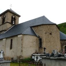
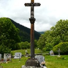
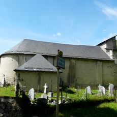
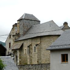
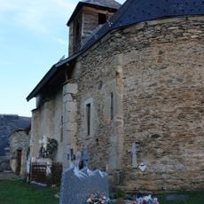
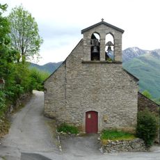
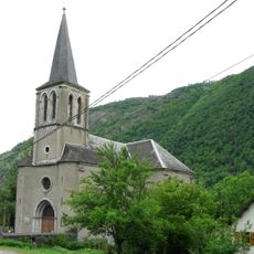
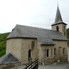
The village was once a larger community with over 200 residents around 1800 but shrank dramatically as people moved to urban areas. The Church of Saint-Félix reflects a long religious tradition that shaped the mountain community across generations.
The village has minimal services, with a baker's van occasionally passing through and nearest shops in neighboring communities. Visitors should plan ahead to bring supplies, as self-sufficiency is necessary in this remote mountain location.
Despite its three residents today, the village was once home to over 200 people and stands as a striking example of rural decline in the French Alps. An annual midsummer festival on June 21st featuring bonfires, music, and communal meals shows how the scattered mountain community keeps traditions alive despite its minimal permanent population.
Location: Haute-Garonne
Location: arrondissement of Saint-Gaudens
Elevation above the sea: 1,542 m
Shares border with: Sost, Benque-Dessous-et-Dessus, Cathervielle, Cirès, Garin, Mayrègne
Address: 31110 Caubous, France
Phone: +33561792460
Email: mairiedecaubous@wibox.fr
GPS coordinates: 42.85114,0.52278
Latest update: December 7, 2025 15:17
France has some municipalities with extremely low populations, not exceeding 12 residents. These villages reflect the demographic shifts in rural France and provide insight into a lifestyle that has become rare. Rochefourchat in Drôme holds the record with just one inhabitant, while Aingoulaincourt in Haute-Marne has 11 residents spread over 510 hectares. These communities are spread across various regions, from Jura with Mérona and its eight residents to Alpes-de-Haute-Provence where Majastres is perched at 1,143 meters above sea level. In Drôme, La Bâtie-des-Fonds marks the source of the Drôme river at over 1,000 meters, while in Doubs, Châteauvieux-les-Fossés overlooks the Loue valley from its rocky promontory. There are also examples in the north, such as Épécamps in Somme with its red brick houses or Leménil-Mitry in Meurthe-et-Moselle.
Église de Saint-Aventin
5.4 km
Château de Saint-Paul-d'Oueil
3.6 km
Église Sainte-Anne
4.9 km
Chapelle Saint-Pé de la Moraine
5 km
Réserve naturelle régionale du massif du Montious
6.8 km
Église Saint-Blaise de Benque-Dessus
4.4 km
Tour à signaux de Castet
5.9 km
Église Saint-Geniès de Benque-Dessous
4.7 km
Église Saint-Julien de Trébons-de-Luchon
6.2 km
Église Saint-Martin de Cazaril-Laspènes
7.2 km
Église Saint-Barthélemy
5.1 km
Tour de Mayrègne
1.5 km
Église Saint-Pierre de Mayrègne
1.8 km
Église Nativité-de-la-Sainte-Vierge de Cirès
547 m
Église Saint-Christophe
4.7 km
Croix de cimetière de Mayrègne
1.8 km
Église Saint-Gordien
3.3 km
Église de Caubous
19 m
Église Saint-Jean-Baptiste de Garin
4.7 km
Église Saint-Barthélémy de Billière
4.5 km
Église Saint-Blaise de Bourg-d'Oueil
2.1 km
Église Saint-Barthélemy de Castillon-de-Larboust
5.2 km
Église Saint-Jacques
6 km
Maison du XVe siècle
463 m
Chapelle de Saint-Aventin
6 km
Église Saint-Simplice
4.8 km
Église d'Antignac
7 km
Église de Portet-de-Luchon
5.1 kmVisited this place? Tap the stars to rate it and share your experience / photos with the community! Try now! You can cancel it anytime.
Discover hidden gems everywhere you go!
From secret cafés to breathtaking viewpoints, skip the crowded tourist spots and find places that match your style. Our app makes it easy with voice search, smart filtering, route optimization, and insider tips from travelers worldwide. Download now for the complete mobile experience.
A unique approach to discovering new places❞
— Le Figaro
All the places worth exploring❞
— France Info
A tailor-made excursion in just a few clicks❞
— 20 Minutes