Buttes de Rosne, Natural ecological zone in Haravilliers, France
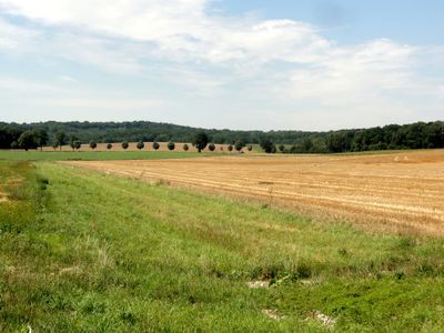
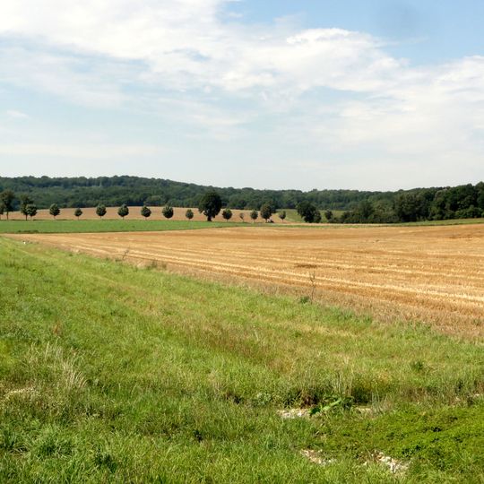
The Buttes de Rosne form an L-shaped outlier hill about four kilometres long, rising to 216 metres on the border of the Val-d'Oise and the Oise. Mown grass slopes up to a band of harvested fields, with a line of trees along the ridge and smaller trees at the field edge. The summit is the highest natural point of the Île-de-France region.
The buttes are remnant hills left by erosion of a Stampian (about 30 million years ago) marine deposit that once covered the Vexin. The sea's retreat exposed the meulière clay layers, which were later quarried in places. The hills have since formed the highest natural ground in the Vexin plateau.
The name Rosne, also written Rône, is attached to a butte-témoin shared by six communes: Haravilliers, Le Heaulme and Neuilly-en-Vexin in the Val-d'Oise, and Chavençon, Hénonville and Neuville-Bosc in the Oise. The meulière clay was dug out at several spots, and the slopes are farmed and grazed around the protected core.
The buttes lie across six communes: Haravilliers, Le Heaulme and Neuilly-en-Vexin in Val-d'Oise, and Chavençon, Hénonville and Neuville-Bosc in Oise. The ZNIEFF protection covers about 407 hectares, only on the Val-d'Oise side. Approach from the Haravilliers lanes; the mown grass slope and stubble field in the photograph are crossed by faint diagonal tracks.
At 216 metres, the summit equals the Butte Saint-Georges in Seine-et-Marne as the highest natural point of Île-de-France; the 231-metre hill of Élancourt near Trappes is taller but made entirely of fill. The argile à meulière was quarried in places on the buttes.
The community of curious travelers
AroundUs brings together thousands of curated places, local tips, and hidden gems, enriched daily by 94,206 contributors worldwide.