Enable Location

We need your location to show you interesting places around you

Discover nearby places

Find interesting locations and hidden gems around you

Precise directions

Get accurate directions and distances to places

Your location is never shared with other users. It's only used when you tap the location button.

Parc de la Briantais

Log in to your account

Start exploring — it's free

Trusted by 61,973 travelers worldwide

Continue with Google
Continue with Apple
or

We will send you a code to connect

By continuing, you accept our Terms and Conditions and our Privacy Policy

Check your inbox

We've sent a pincode in your inbox. Please enter the code below.

Parc de la Briantais

Parc de la Briantais, Urban park next to Rance Estuary in Saint-Malo, France.

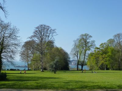
Parc de la Briantais is an expansive green space beside the Rance Estuary in Saint-Malo, set on raised terrain that slopes toward the water. The park features interconnected walking paths that wind through forested sections and open areas with diverse plant life.

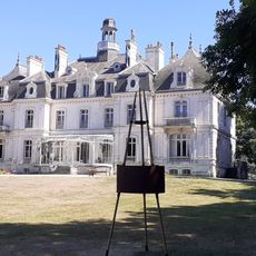
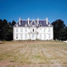
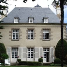
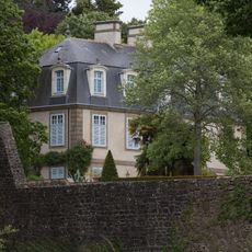
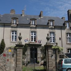
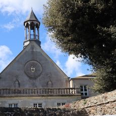
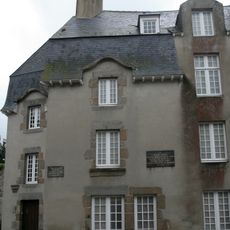
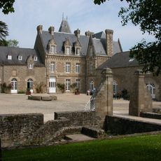
The land was originally an estate with a manor house from the 17th century, which was later replaced by a castle built in 1850. This castle and its surrounding grounds were eventually transformed into a public space for the community.

The park serves as a gathering space where local visitors explore native plants and learn about the regional environment. People walk here regularly to connect with the landscape and observe how it changes through the seasons.

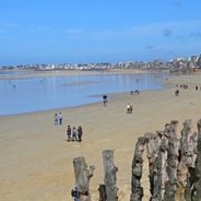
The park is easily accessible on foot from Saint-Malo's old town and features open paths with varying difficulty levels. Visitors should wear good walking shoes since the terrain is hilly and paths can become slippery in wet weather.

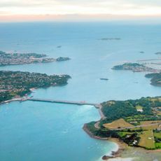
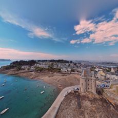
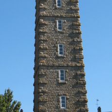
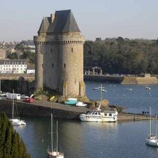
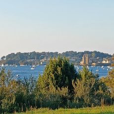
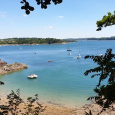
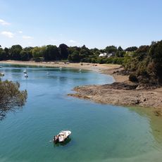
From the elevated sections of the park, visitors can see the Solidor Tower, the Bay of Saint-Malo, and the entire Rance Estuary spread before them. This view is especially memorable in late afternoon when light plays across the water.

The community of curious travelers

AroundUs brings together thousands of curated places, local tips, and hidden gems, enriched daily by 60,000 contributors worldwide.

Start exploring
Location
GPS coordinates
48.62000,-2.01400
Latest update
December 6, 2025 17:46
Saint-Malo: sandy beaches, stone walls, coast paths

Saint-Malo is a seaside town where stone is everywhere. Strong city walls surround the old part. Gray granite streets lead down to the harbor. Sand beaches stretch along the walls. Walking on the walls, you see the bay and islands on the horizon. Fort National sits on its island, reachable at low...

« Parc de la Briantais - Urban park next to Rance Estuary in Saint-Malo, France » is provided by Around Us (aroundus.com). Images and texts are derived from Wikimedia project under a Creative Commons license. You are allowed to copy, distribute, and modify copies of this page, under the conditions set by the license, as long as this note is clearly visible.

Discover hidden gems everywhere you go!

From secret cafés to breathtaking viewpoints, skip the crowded tourist spots and find places that match your style. Our app makes it easy with voice search, smart filtering, route optimization, and insider tips from travelers worldwide. Download now for the complete mobile experience.

Around Us App Screenshot

A unique approach to discovering new places

Le Figaro

All the places worth exploring

France Info

A tailor-made excursion in just a few clicks

20 Minutes

Around Us
Travel Guide & Maps
Download

Send to your phone

QR Code
1

Open the camera app on your mobile.

2

Point at the QR code with your camera. A notification will appear.

3

Tap the notification to open the link.