Puy de Manse, Mountain summit and viewpoint in Ancelle, La Rochette and Forest-Saint-Julien, France
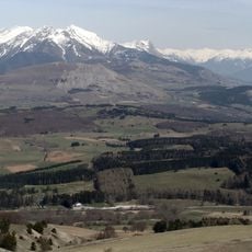
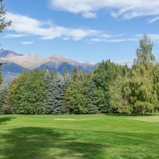
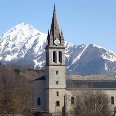
Puy de Manse is an isolated summit at the southwestern end of the Écrins Massif, reaching 1,637 m on the watershed between Champsaur and Gapençais. Its elongated ovoid pyramid carries two secondary tops, north at 1,497 m and south at 1,621 m, and rises over 300 m above the surrounding hills. The flanks are shared by Ancelle, La Rochette and Forest-Saint-Julien.
The sources record no geological origin for Puy de Manse; its documented history is artistic. Photographer Brigitte Palaggi and writer Olivier Domerg surveyed the mountain from 2009 to 2021, producing the trilogy Fragments d'un mont-monde and the exhibition "Le Puy de Manse, fragments d'un mont-monde" at the Musée muséum départemental des Hautes-Alpes from 18 May to 31 October 2013.
The mountain's name appears in a trilogy by photographer Brigitte Palaggi and writer Olivier Domerg, who surveyed the site from 2009 to 2021; the first volume is titled Portrait de Manse en Sainte-Victoire molle (2011). An exhibition, "Le Puy de Manse, fragments d'un mont-monde", ran at the Musée muséum départemental des Hautes-Alpes from 18 May to 31 October 2013. Farmers still graze cows and sheep on the grass here in summer and collect them in autumn.
No road reaches the flanks and no marked trail leads to the summit; the only paths are those worn by grazing herds, which can be followed except on the steep, bare western face. The climb gains 300 to 350 metres depending on the starting point. An easy waymarked circuit instead goes around the mountain, signposted from La Rochette on the D 14, with a branch to the Chapeau de Napoléon cliff.
The geographical position at coordinates 44.6145282° N and 6.1557897° E allows observers to spot both the Alpine peaks and Mediterranean influences in the landscape.
The community of curious travelers
AroundUs brings together thousands of curated places, local tips, and hidden gems, enriched daily by 92,811 contributors worldwide.