Enable Location

We need your location to show you interesting places around you

Discover nearby places

Find interesting locations and hidden gems around you

Precise directions

Get accurate directions and distances to places

Your location is never shared with other users. It's only used when you tap the location button.

Puy de Montoncel

Log in to your account

Start exploring — it's free

Trusted by 61,928 travelers worldwide

Continue with Google
Continue with Apple
or

We will send you a code to connect

By continuing, you accept our Terms and Conditions and our Privacy Policy

Check your inbox

We've sent a pincode in your inbox. Please enter the code below.

Puy de Montoncel

Puy de Montoncel, Mountain summit in Bois Noirs, France

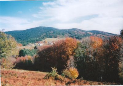
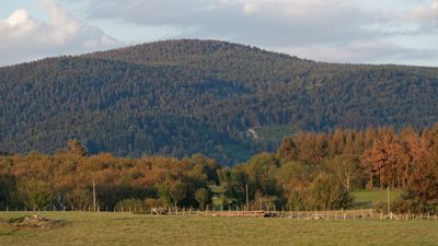
Puy de Montoncel is a mountain summit in the Massif Central located where Loire, Puy-de-Dôme, and Allier departments meet. The peak stands at 1287 meters and rises over open moors in a relatively undulating terrain.

The area received Natura 2000 protection status in 1995 to safeguard the last mountain moors of the massif. This designation helped secure the fragile ecosystems of the region for future generations.

The name of this summit connects to 'monachus tonsura', a reference to how the bare peak resembles a monk's shaved head. This link to monastic tradition shapes how local people think about the mountain today.

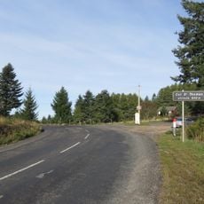
The summit can be reached through marked trails from Col de la Charme, Col des Planchettes, or the villages of La Lizolle and Les Cros. Each route offers different levels of effort and duration, with all paths clearly marked for walkers.

The slopes of this summit contain the sources of the Besbre River and tributaries of the Durolle and Credogne that feed the La Muratte dam. These hidden water sources make the mountain an important watershed for the region.

The community of curious travelers

AroundUs brings together thousands of curated places, local tips, and hidden gems, enriched daily by 60,000 contributors worldwide.

Start exploring
Location
Location
Location
GPS coordinates
45.93081,3.69405
Latest update
December 12, 2025 07:57
« Puy de Montoncel - Mountain summit in Bois Noirs, France » is provided by Around Us (aroundus.com). Images and texts are derived from Wikimedia project under a Creative Commons license. You are allowed to copy, distribute, and modify copies of this page, under the conditions set by the license, as long as this note is clearly visible.

Discover hidden gems everywhere you go!

From secret cafés to breathtaking viewpoints, skip the crowded tourist spots and find places that match your style. Our app makes it easy with voice search, smart filtering, route optimization, and insider tips from travelers worldwide. Download now for the complete mobile experience.

Around Us App Screenshot

A unique approach to discovering new places

Le Figaro

All the places worth exploring

France Info

A tailor-made excursion in just a few clicks

20 Minutes

Around Us
Travel Guide & Maps
Download

Send to your phone

QR Code
1

Open the camera app on your mobile.

2

Point at the QR code with your camera. A notification will appear.

3

Tap the notification to open the link.