Chest opened
+${chestReward.xp} XP
Explorer
NOUVEAU ×${chestReward.collectible.quantity}
tapez pour fermer

See the monuments around you in AR Open chests in the app

Around Us is built for your phone — point your camera at the streets and discover the monuments and places around you in augmented reality. Around Us is built for your phone — chests unlock when you walk, explore and capture nearby places.

•

Enable Location

We need your location to show you interesting places around you

Discover nearby places

Find interesting locations and hidden gems around you

Precise directions

Get accurate directions and distances to places

Your location is never shared with other users. It's only used when you tap the location button.

Donjon de Broue

Log in to your account

Start exploring — it's free

Trusted by 94,658 travelers worldwide

Continue with Google
Continue with Apple
or

We will send you a code to connect

By continuing, you accept our Terms and Conditions and our Privacy Policy

Check your inbox

We've sent a pincode in your inbox. Please enter the code below.

Donjon de Broue, Medieval tower in Saint-Sornin, France

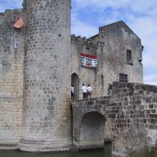
The Donjon de Broue is a ruined quadrangular keep, now 25 metres high, on a rocky mound in the Brouage marshes. Its walls of small pale stone blocks are strengthened by flat buttresses, and two narrow vertical openings sit above a larger irregular hole. The top edge is broken, and yellow lichen marks the stone.

A castle at Broue is first mentioned in a 1047 charter, when Geoffroy Martel, son of Foulques Nerra, held it; the keep may be among the oldest in France. In 1372 Bertrand du Guesclin besieged and retook it from the English, freeing Isabelle de Valois. The sires de Pons held it until the early 17th century, then abandoned it as the gulf silted up; by the 18th century Claude Masse's maps show it already ruined.

Broue was a salt-trading port: the lords of Broue drew most of their income from the salt pans, and in 1244 Geoffroy de Doué was fined for failing to maintain his harbour. The settlement once had two churches, Saint-Pierre and Saint-Eutrope, of which nothing remains.

The tower sits in a rural location accessible by local roads and best reached by car. Visitors should plan for walking time to reach the site and check access permissions beforehand.

The tower's four surviving levels once stood about 30 metres high; today they reach 25 metres. It probably served as a landmark for ships crossing the old Gulf of Saintonge, guiding vessels toward the salt port at its base.

The community of curious travelers

AroundUs brings together thousands of curated places, local tips, and hidden gems, enriched daily by 94,658 contributors worldwide.

Start exploring
Location
GPS coordinates
45.78740,-0.97590
Latest update
October 26, 2026 08:26
Reviews
Share your experience

No review yet

Discussions
Start a discussion...

No discussion yet

« Donjon de Broue - Medieval tower in Saint-Sornin, France » is provided by Around Us (aroundus.com). Images and texts are derived from Wikimedia project under a Creative Commons license. You are allowed to copy, distribute, and modify copies of this page, under the conditions set by the license, as long as this note is clearly visible.

Discover hidden gems everywhere you go!

From secret cafés to breathtaking viewpoints, skip the crowded tourist spots and find places that match your style. Our app makes it easy with voice search, smart filtering, route optimization, and insider tips from travelers worldwide. Download now for the complete mobile experience.

Around Us App Screenshot
❝

A unique approach to discovering new places❞

— Le Figaro

❝

All the places worth exploring❞

— France Info

❝

A tailor-made excursion in just a few clicks❞

— 20 Minutes

Around Us
Travel Guide & Maps
Download

Send to your phone

QR Code
1

Open the camera app on your mobile.

2

Point at the QR code with your camera. A notification will appear.

3

Tap the notification to open the link.