Enable Location

We need your location to show you interesting places around you

Discover nearby places

Find interesting locations and hidden gems around you

Precise directions

Get accurate directions and distances to places

Your location is never shared with other users. It's only used when you tap the location button.

Mont Avison

Log in to your account

Start exploring — it's free

Trusted by 63,468 travelers worldwide

Continue with Google
Continue with Apple
or

We will send you a code to connect

By continuing, you accept our Terms and Conditions and our Privacy Policy

Check your inbox

We've sent a pincode in your inbox. Please enter the code below.

Discussion Reviews 1 Photos
800+ Popularity

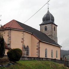
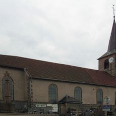
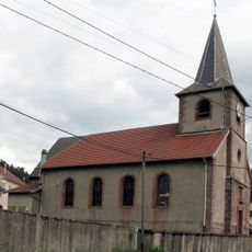
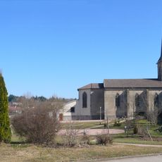
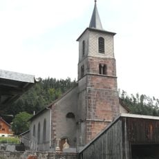
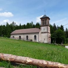
Mont Avison, Archaeological site and viewpoint at Mont Avison, France.

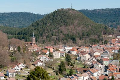
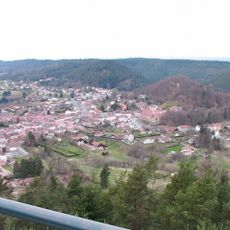
Mont Avison is a mountain in the Vosges rising to 593 meters with remains of an ancient settlement on its slopes. A wooden lookout tower at the top provides panoramic views over the surrounding valleys and peaks.

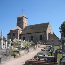
Roman settlers occupied the mountain between the 3rd and 4th centuries as a strategic location. Excavations during the late 1960s uncovered coins, pottery, and building foundations from this period.

The name Mont Avison comes from a local word for hazelnut, reflecting the mountain's botanical heritage. The presence of ruins and artifacts shows that people have long been drawn to this place for shelter and views.

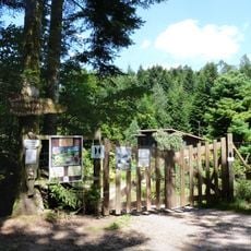
The hiking trail from Bruyères to the summit is marked with red triangles and takes roughly 90 minutes to walk. Plan your visit for clear weather when the tower is accessible and the views extend far across the landscape.

The Arentèle river springs from the northern slope of this mountain and marks the start of an important waterway. Along the path, visitors come across a wooden sculpture called 'L'Ogre de l'Avison' that reflects local artistic traditions.

The community of curious travelers

AroundUs brings together thousands of curated places, local tips, and hidden gems, enriched daily by 60,000 contributors worldwide.

Start exploring
Location
Elevation above the sea
593 m
GPS coordinates
48.20974,6.72958
Latest update
December 14, 2025 20:01
Around this place
Jardin botanique de Gondremer
France

Jardin botanique de Gondremer

9.2 km
Château de Bruyères
France

Château de Bruyères

959 m
Église Notre-Dame de Champ-le-Duc
France

Église Notre-Dame de Champ-le-Duc

2.1 km
France

Église Sainte-Libaire de Lépanges-sur-Vologne

6 km
Église Notre-Dame-de-l'Assomption de Bruyères
France

Église Notre-Dame-de-l'Assomption de Bruyères

719 m
Église Sainte-Menne de Deycimont
France

Église Sainte-Menne de Deycimont

7.6 km
Musée Henri-Mathieu
France

Musée Henri-Mathieu

520 m
Église Saint-Laurent du Haut-de-Belmont
France

Église Saint-Laurent du Haut-de-Belmont

2.2 km
Église Sainte-Menne de La Chapelle-devant-Bruyères
France

Église Sainte-Menne de La Chapelle-devant-Bruyères

5.1 km
Église de la Nativité-de-Notre-Dame de Champdray
France

Église de la Nativité-de-Notre-Dame de Champdray

8.5 km
Église du Sacré-Cœur de Laveline-devant-Bruyères
France

Église du Sacré-Cœur de Laveline-devant-Bruyères

3.1 km
Église Saint-Antoine de Biffontaine
France

Église Saint-Antoine de Biffontaine

5.6 km
Église Saint-Jacques de Viménil
France

Église Saint-Jacques de Viménil

7.4 km
Église de la Nativité-de-Notre-Dame de Grandvillers
France

Église de la Nativité-de-Notre-Dame de Grandvillers

5.7 km
Église de l'Assomption-de-Notre-Dame de Gugnécourt
France

Église de l'Assomption-de-Notre-Dame de Gugnécourt

8.9 km
Église Saint-Léger-et-Sainte-Gébertrude de Jussarupt
France

Église Saint-Léger-et-Sainte-Gébertrude de Jussarupt

5.2 km
Église de l'Assomption-de-Notre-Dame de Méménil
France

Église de l'Assomption-de-Notre-Dame de Méménil

8.9 km
Église Saint-Mathieu de Mortagne
France

Église Saint-Mathieu de Mortagne

6.9 km
Église Sainte-Madeleine de Laval-sur-Vologne
France

Église Sainte-Madeleine de Laval-sur-Vologne

2.9 km
Chapelle Notre-Dame-de-la-Roche à Bruyères
France

Chapelle Notre-Dame-de-la-Roche à Bruyères

385 m
Église Saint-Georges de Granges-sur-Vologne
France

Église Saint-Georges de Granges-sur-Vologne

8.5 km
Église Saint-Pierre-ès-Liens de Fremifontaine
France

Église Saint-Pierre-ès-Liens de Fremifontaine

7.8 km
Église de l'Exaltation-de-la-Sainte-Croix de Brouvelieures
France

Église de l'Exaltation-de-la-Sainte-Croix de Brouvelieures

2.9 km
Église Saint-Gengoult de Pierrepont-sur-l'Arentèle
France

Église Saint-Gengoult de Pierrepont-sur-l'Arentèle

8.6 km
Église Saint-Jean-Baptiste de Saint-Jean-du-Marché
France

Église Saint-Jean-Baptiste de Saint-Jean-du-Marché

8.1 km
Église Saint-Jean-Baptiste des Rouges-Eaux
France

Église Saint-Jean-Baptiste des Rouges-Eaux

8 km
Église Notre-Dame-du-Rosaire d'Aumontzey
France

Église Notre-Dame-du-Rosaire d'Aumontzey

6 km
Croix de cimetière de Brouvelieures
France

Croix de cimetière de Brouvelieures

2.8 km
Show the full map
Reviews
Share your experience

No review yet

Discussions
Start a discussion...

No discussion yet

« Mont Avison - Archaeological site and viewpoint at Mont Avison, France » is provided by Around Us (aroundus.com). Images and texts are derived from Wikimedia project under a Creative Commons license. You are allowed to copy, distribute, and modify copies of this page, under the conditions set by the license, as long as this note is clearly visible.

Discover hidden gems everywhere you go!

From secret cafés to breathtaking viewpoints, skip the crowded tourist spots and find places that match your style. Our app makes it easy with voice search, smart filtering, route optimization, and insider tips from travelers worldwide. Download now for the complete mobile experience.

Around Us App Screenshot

A unique approach to discovering new places

Le Figaro

All the places worth exploring

France Info

A tailor-made excursion in just a few clicks

20 Minutes

Around Us
Travel Guide & Maps
Download

Send to your phone

QR Code
1

Open the camera app on your mobile.

2

Point at the QR code with your camera. A notification will appear.

3

Tap the notification to open the link.