Le Méale, Mountain summit in the Hautes-Alpes, France.
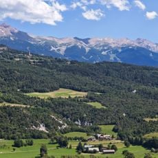
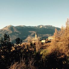
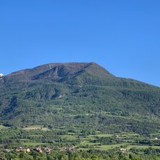
Le Méale is a mountain in the Parpaillon massif, rising to 2,426 m above the commune of Crévoux in the Hautes-Alpes department of France. Its upper slopes form a long ridge that climbs gently from the left to a rounded top, with a band of pale rock and scree running beneath the crest. Dark green trees cover the higher slopes, giving way to lighter grassy patches lower down, and a pale eroded bluff cuts into the hillside on the left. A valley with a few buildings and a road lies below the summit.
Le Méale belongs to the Parpaillon massif, the range that also holds the Grand Parpaillon and the nearby Pic St-André, 2,863 m, about 5.3 km away. The summit rises within the commune of Crévoux in the Hautes-Alpes department, roughly 6.7 km from Embrun. The sources record no herding structures or dated events on the mountain itself.
Le Méale lies in the Parpaillon massif above Crévoux, and its name is the everyday reference for the mountain in the valley below. The summit is a viewpoint over the buildings and road of that valley, with the Pic St-André rising about 5.3 km to the north.
The hike starts from Praveyral hamlet where parking is limited. The route involves a 960-meter elevation gain across forest trails and open mountain terrain.
Le Méale lies in the Parpaillon massif, and the higher Pic St-André (2,863 m) stands about 5.3 km to its southwest. The summit is only 107 m above the surrounding terrain, with a base width of roughly 0.73 km, so it reads as a rounded shoulder rather than a sharp peak.
The community of curious travelers
AroundUs brings together thousands of curated places, local tips, and hidden gems, enriched daily by 93,989 contributors worldwide.