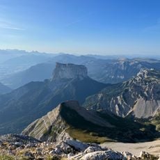
Tête de Cognaux, Mountain summit in Isère department, France
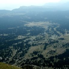
Tête de Cognaux is a mountain summit in the Isère region that rises to about 1,684 meters (5,525 feet) above sea level. Several hiking trails cross the area, winding through open alpine terrain.
The summit was recorded in French surveying records during the early 20th century and documented as a geographic reference point. Its precise mapping reflects the systematic charting of the Alps during that period.
Local shepherds from surrounding valleys maintain the tradition of using Tête de Cognaux slopes for summer grazing of their livestock.
This area is best visited during dry weather and requires proper hiking gear. Visitors should always check weather forecasts before heading out, as mountain conditions can change quickly.
The summit's exact geographical position at 44°55'11.755 North latitude and 5°29'52.696 East longitude serves as a topographical reference point.
The community of curious travelers
AroundUs brings together thousands of curated places, local tips, and hidden gems, enriched daily by 60,000 contributors worldwide.