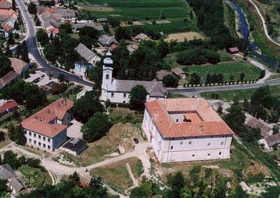
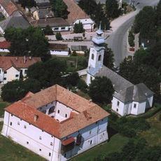
Ozora, village in Tolna County, Hungary
Ozora is a small municipality in Tamási District, Hungary, located in the Somogy region. The settlement has a rural character with traditional buildings and green spaces that shape the appearance of a typical Hungarian village community.
The area around Ozora, like many Hungarian rural communities, has a long history tied to various phases of regional development. The village developed as an agricultural settlement, and its structure still reflects this traditional land-use heritage.
For visitors wanting to explore rural Hungary, this place offers a quiet and authentic setting. The best time to visit is during warmer months, when the countryside appears green and active.
The community of curious travelers
AroundUs brings together thousands of curated places, local tips, and hidden gems, enriched daily by 60,000 contributors worldwide.