
Mersevát, village in Hungary
Location: Celldömölk District
Inception: 1906
Elevation above the sea: 125 m
Shares border with: Külsővat, Kemenesmagasi, Vönöck, Kemenesszentmárton, Kemenessömjén, Celldömölk
Website: http://mersevat.hu
GPS coordinates: 47.28910,17.20603
Latest update: November 21, 2025 12:45
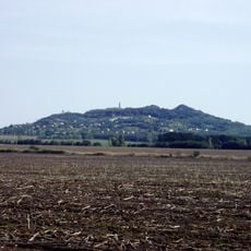
Ság Mountain
9.4 km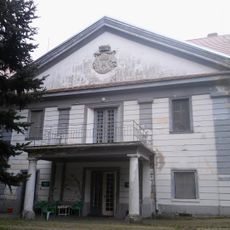
Batthyány-Strattmann Mansion, Intaháza
10.2 km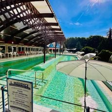
Borgáta Termálfürdő
16.2 km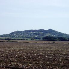
Zone de protection paysagère de Sághegy
9.1 km
László Nagy Memorial House
14 km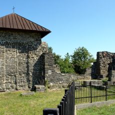
Dömölk Abbey
6 km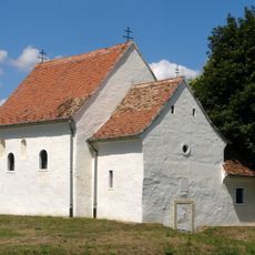
Iglesia de San Miguel
10.9 km
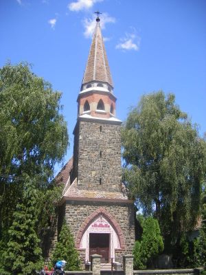
Lutheran church in Celldömölk
5.9 km
Mesteri Termálfürdő
11.6 km
Szentháromság-oszlop
14.7 km
Fa harangláb
10.9 km
Romok
13.7 km
Romtemplom
6.3 km
Egykori vasúti híd maradványa
3.3 km
Romok
14.3 km
Vulkán Gyógy- és Élményfürdő
7 km
Piéta szobor
11.5 km
Gőzmozdony 3
5.2 km
Statue, Work of art
5.3 km
Statue, Work of art
11.5 km
Scenic viewpoint
6.5 km
Scenic viewpoint
6.6 km
Magánkilátó
11.2 km
Scenic viewpoint
9.2 km
Scenic viewpoint
9.4 km
Scenic viewpoint
9.3 km
Scenic viewpoint
9.3 km
Scenic viewpoint
9.2 kmReviews
Visited this place? Tap the stars to rate it and share your experience / photos with the community! Try now! You can cancel it anytime.
Discover hidden gems everywhere you go!
From secret cafés to breathtaking viewpoints, skip the crowded tourist spots and find places that match your style. Our app makes it easy with voice search, smart filtering, route optimization, and insider tips from travelers worldwide. Download now for the complete mobile experience.

A unique approach to discovering new places❞
— Le Figaro
All the places worth exploring❞
— France Info
A tailor-made excursion in just a few clicks❞
— 20 Minutes