Chest opened
+${chestReward.xp} XP
Explorer
NOUVEAU ×${chestReward.collectible.quantity}
tapez pour fermer
Chest locked

Open chests in the app

Around Us is built for your phone — chests unlock when you walk, explore and capture nearby places.

Enable Location

We need your location to show you interesting places around you

Discover nearby places

Find interesting locations and hidden gems around you

Precise directions

Get accurate directions and distances to places

Your location is never shared with other users. It's only used when you tap the location button.

Highway 60

Log in to your account

Start exploring — it's free

Trusted by 72,891 travelers worldwide

Continue with Google
Continue with Apple
or

We will send you a code to connect

By continuing, you accept our Terms and Conditions and our Privacy Policy

Check your inbox

We've sent a pincode in your inbox. Please enter the code below.

Highway 60
Discussion Reviews 1 Photos
18.8k Popularity

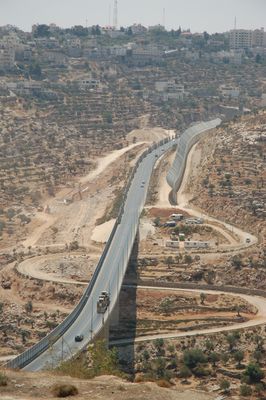
Highway 60, road in West Bank

Highway 60 is a road running through Israel and the West Bank, stretching from Nablus in the north to Jerusalem in the south. The route passes through varying landscapes with hills and flat terrain, crossing through cities, towns, and rural areas, appearing paved in some sections and dusty in others.

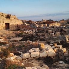
Highway 60 follows a route used for thousands of years, known as 'The Way of the Patriarchs' and traveled by biblical figures such as Abraham, Isaac, and Jacob. It remains a main route today, connecting important cities like Nazareth, Bethlehem, and Beersheba, with its significance enduring from ancient times.

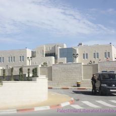
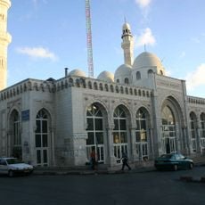
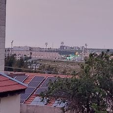
Highway 60 passes through cities and villages where markets, shops, and homes line the route, reflecting daily life in the region. The road connects different communities, each with its own character and traditions, showing the cultural diversity across the areas it traverses.

The road varies in construction across different sections: multiple lanes with traffic signals in the south, mostly two lanes without dividers in the north, and winding and narrow through hilly areas. Travelers should expect checkpoints and barriers to slow passage, and navigation may be safer with local buses or familiar drivers.

Along the route are hitchhiking posts called trempiadas where people in rural areas wait for rides, offering a window into daily life in the region. These stops are woven into local routines and show how residents depend on the road for travel to work and family visits.

The community of curious travelers

AroundUs brings together thousands of curated places, local tips, and hidden gems, enriched daily by 60,000 contributors worldwide.

Start exploring
GPS coordinates
31.89833,35.26528
Latest update
February 16, 2026 23:20
Reviews
Share your experience

No review yet

Discussions
Start a discussion...

No discussion yet

« Highway 60 - road in West Bank » is provided by Around Us (aroundus.com). Images and texts are derived from Wikimedia project under a Creative Commons license. You are allowed to copy, distribute, and modify copies of this page, under the conditions set by the license, as long as this note is clearly visible.

Discover hidden gems everywhere you go!

From secret cafés to breathtaking viewpoints, skip the crowded tourist spots and find places that match your style. Our app makes it easy with voice search, smart filtering, route optimization, and insider tips from travelers worldwide. Download now for the complete mobile experience.

Around Us App Screenshot

A unique approach to discovering new places

Le Figaro

All the places worth exploring

France Info

A tailor-made excursion in just a few clicks

20 Minutes

Around Us
Travel Guide & Maps
Download

Send to your phone

QR Code
1

Open the camera app on your mobile.

2

Point at the QR code with your camera. A notification will appear.

3

Tap the notification to open the link.