Dima Hasao district

Log in to your account

AroundUs is a community-driven map of interesting places, built by curious explorers like you. It grows with every review, story, and photo you share.
Connect to save your favorite spots, contribute locations, and create personalized routes.
Continue with Google
Continue with Apple
Continue with X
Continue with Facebook
Continue with email
By continuing, you accept our Terms and Conditions and our Privacy Policy
Create an account
Add to collection
Map
Suggest a change
Share

Dima Hasao district, Administrative district in Central Assam, India

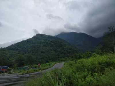
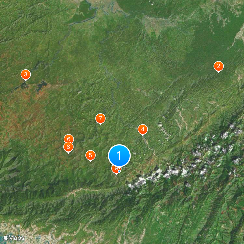
Dima Hasao is an administrative district in Central Assam covering hilly, forested terrain crossed by rivers, with Haflong as its capital situated at 513 meters elevation. The district spans roughly 4,890 square kilometers and serves as a connection point for surrounding regions.

The area was once the heart of the Dimasa Kingdom, which ruled from 1500 with capitals at Maibang and Dimapur. British colonial authorities later established administrative centers at Gunjung and Haflong.

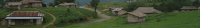
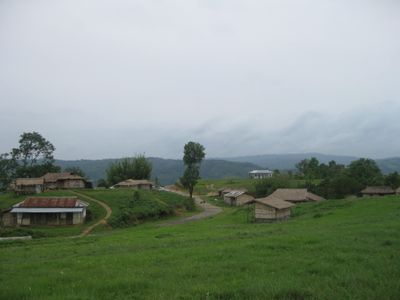
Thirteen tribal communities including Dimasa, Kuki, Zeme, and Hmar peoples live throughout the region, each maintaining distinct languages and customs visible in daily life and local celebrations. Walking through villages and markets, you notice different cooking styles, clothing, and ways people gather and work together.

The region has moderate temperatures year-round, ranging between 8 to 30 degrees Celsius, making it accessible in different seasons. Haflong serves as the main hub with lodging options and good access to surrounding villages and natural areas.

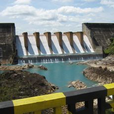
The village of Jatinga attracts attention for the puzzling behavior of migratory birds during certain months when hundreds mysteriously plunge to the ground. The Panimur waterfall is among the tallest cascades in Northeast India and offers a dramatic natural spectacle.

Location: Central Assam division

Inception: 1970

Capital city: Haflong

Elevation above the sea: 513 m

Shares border with: Karbi Anglong district, Cachar district

Website: http://nchills.gov.in

GPS coordinates: 25.18000,93.03000

Latest update: December 17, 2025 08:05

Photos
Reviews

Visited this place? Tap the stars to rate it and share your experience / photos with the community! Try now! You can cancel it anytime.

« Dima Hasao district - Administrative district in Central Assam, India » is provided by Around Us (aroundus.com). Images and texts are derived from Wikimedia project under a Creative Commons license. You are allowed to copy, distribute, and modify copies of this page, under the conditions set by the license, as long as this note is clearly visible.

Discover hidden gems everywhere you go!

From secret cafés to breathtaking viewpoints, skip the crowded tourist spots and find places that match your style. Our app makes it easy with voice search, smart filtering, route optimization, and insider tips from travelers worldwide. Download now for the complete mobile experience.

Around Us App Screenshot

A unique approach to discovering new places

Le Figaro

All the places worth exploring

France Info

A tailor-made excursion in just a few clicks

20 Minutes