Enable Location

We need your location to show you interesting places around you

Discover nearby places

Find interesting locations and hidden gems around you

Precise directions

Get accurate directions and distances to places

Your location is never shared with other users. It's only used when you tap the location button.

Log in to your account

Start exploring — it's free

Trusted by 61,968 travelers worldwide

Continue with Google
Continue with Apple
or

We will send you a code to connect

By continuing, you accept our Terms and Conditions and our Privacy Policy

Check your inbox

We've sent a pincode in your inbox. Please enter the code below.

Darbhanga district

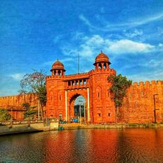
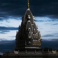
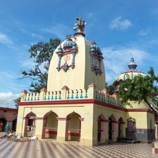
Darbhanga district, Administrative district in Bihar, India

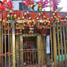
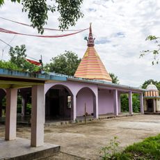
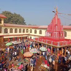
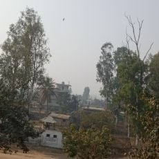
Darbhanga is an administrative district in eastern Bihar with several temples, schools, and busy markets spread across multiple towns. The landscape is mostly flat and features rivers that run through the area, shaping its geography.

The area was the center of the ancient Mithila kingdom, which played an important role in early Indian history. Over centuries, the region experienced changes under various rulers before becoming part of modern India.

The region holds deep roots in Mithila art traditions that you can see in homes and during local celebrations. This artistic heritage shapes daily life and continues to be passed down through families.

The area is well connected by train stations in several towns, with local buses and auto-rickshaws providing transportation to smaller places. Visitors should allow time for traveling between different locations, as distances can be considerable.

The area is home to Kusheshwar Bird Sanctuary, where rare waterfowl gather in large numbers during the monsoon season. This location often surprises birdwatchers since it receives less attention than other wildlife areas in the country.

The community of curious travelers

AroundUs brings together thousands of curated places, local tips, and hidden gems, enriched daily by 60,000 contributors worldwide.

Start exploring
Capital city
Darbhanga
Shares border with
Madhubani district, Saharsa district
GPS coordinates
26.00000,86.00000
Latest update
December 20, 2025 00:23
« Darbhanga district - Administrative district in Bihar, India » is provided by Around Us (aroundus.com). Images and texts are derived from Wikimedia project under a Creative Commons license. You are allowed to copy, distribute, and modify copies of this page, under the conditions set by the license, as long as this note is clearly visible.

Discover hidden gems everywhere you go!

From secret cafés to breathtaking viewpoints, skip the crowded tourist spots and find places that match your style. Our app makes it easy with voice search, smart filtering, route optimization, and insider tips from travelers worldwide. Download now for the complete mobile experience.

Around Us App Screenshot

A unique approach to discovering new places

Le Figaro

All the places worth exploring

France Info

A tailor-made excursion in just a few clicks

20 Minutes

Around Us
Travel Guide & Maps
Download

Send to your phone

QR Code
1

Open the camera app on your mobile.

2

Point at the QR code with your camera. A notification will appear.

3

Tap the notification to open the link.