Enable Location

We need your location to show you interesting places around you

Discover nearby places

Find interesting locations and hidden gems around you

Precise directions

Get accurate directions and distances to places

Your location is never shared with other users. It's only used when you tap the location button.

Sitamarhi district

Log in to your account

Start exploring — it's free

Trusted by 62,543 travelers worldwide

Continue with Google
Continue with Apple
or

We will send you a code to connect

By continuing, you accept our Terms and Conditions and our Privacy Policy

Check your inbox

We've sent a pincode in your inbox. Please enter the code below.

Sitamarhi district

Sitamarhi district, Administrative district in Tirhut division, India.

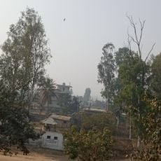
Sitamarhi district is located in northern Bihar state near the Nepal border and is organized into several administrative subdivisions. Agricultural land and rural settlements define the landscape throughout the region.

The district became an independent administrative entity in 1972 after separating from Muzaffarpur district. This administrative reorganization gave the region its own local governance structure.

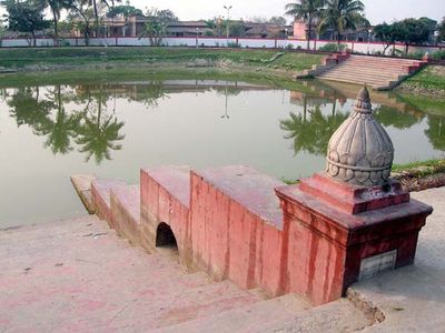
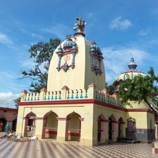
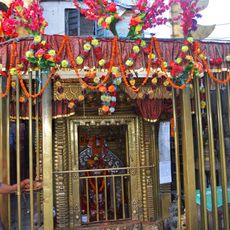
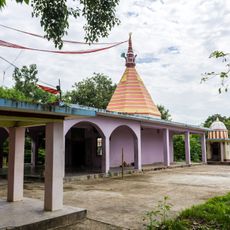
The district holds spiritual significance through sacred sites where pilgrims gather for religious observances throughout the year. These places remain central to how local communities practice and express their faith.

National Highway 77 connects the district to larger cities for road travel throughout the region. Sitamarhi Junction railway station provides train connections, while the nearest airport is located roughly 80 kilometers away.

Ancient temple and sanctuary complexes were constructed during the Mauryan period and remain visible in the district today. These archaeological remains demonstrate the spiritual importance of the area spanning thousands of years.

The community of curious travelers

AroundUs brings together thousands of curated places, local tips, and hidden gems, enriched daily by 60,000 contributors worldwide.

Start exploring
Location
Capital city
Sitamarhi
Shares border with
Sheohar district, Madhubani district
GPS coordinates
26.60000,85.48333
Latest update
December 13, 2025 17:39
« Sitamarhi district - Administrative district in Tirhut division, India » is provided by Around Us (aroundus.com). Images and texts are derived from Wikimedia project under a Creative Commons license. You are allowed to copy, distribute, and modify copies of this page, under the conditions set by the license, as long as this note is clearly visible.

Discover hidden gems everywhere you go!

From secret cafés to breathtaking viewpoints, skip the crowded tourist spots and find places that match your style. Our app makes it easy with voice search, smart filtering, route optimization, and insider tips from travelers worldwide. Download now for the complete mobile experience.

Around Us App Screenshot

A unique approach to discovering new places

Le Figaro

All the places worth exploring

France Info

A tailor-made excursion in just a few clicks

20 Minutes

Around Us
Travel Guide & Maps
Download

Send to your phone

QR Code
1

Open the camera app on your mobile.

2

Point at the QR code with your camera. A notification will appear.

3

Tap the notification to open the link.