Enable Location

We need your location to show you interesting places around you

Discover nearby places

Find interesting locations and hidden gems around you

Precise directions

Get accurate directions and distances to places

Your location is never shared with other users. It's only used when you tap the location button.

Log in to your account

Start exploring — it's free

Trusted by 62,570 travelers worldwide

Continue with Google
Continue with Apple
or

We will send you a code to connect

By continuing, you accept our Terms and Conditions and our Privacy Policy

Check your inbox

We've sent a pincode in your inbox. Please enter the code below.

Balaghat district

Balaghat district, Administrative district in Jabalpur division, India

Balaghat district is an administrative region in southern Madhya Pradesh where forests dominate most of the landscape. The Wainganga River flows through the area from north to south, providing water resources to local communities.

The district took shape between 1867 and 1873 when colonial administrations combined territories from neighboring areas. This administrative restructuring established the boundaries that define the district today.

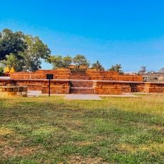
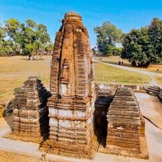
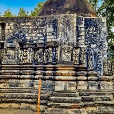
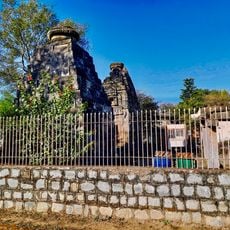
The region is home to several communities that maintain traditional crafts and farming practices visible in local villages and markets today. These customs continue to shape how people live and work throughout the district.

The best time to visit is during or shortly after the rainy season when forests are green and water is plentiful. Visitors should be prepared for basic roads and limited facilities in smaller communities.

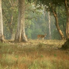
The forests shelter tigers and leopards in their natural habitat, making the district an important sanctuary for these endangered animals. This wildlife-rich character sets the region apart from other administrative areas in the surrounding region.

The community of curious travelers

AroundUs brings together thousands of curated places, local tips, and hidden gems, enriched daily by 60,000 contributors worldwide.

Start exploring
Inception
1867
Capital city
Balaghat
Shares border with
Mandla district, Rajnandgaon district
GPS coordinates
21.96667,80.33333
Latest update
December 20, 2025 02:49
« Balaghat district - Administrative district in Jabalpur division, India » is provided by Around Us (aroundus.com). Images and texts are derived from Wikimedia project under a Creative Commons license. You are allowed to copy, distribute, and modify copies of this page, under the conditions set by the license, as long as this note is clearly visible.

Discover hidden gems everywhere you go!

From secret cafés to breathtaking viewpoints, skip the crowded tourist spots and find places that match your style. Our app makes it easy with voice search, smart filtering, route optimization, and insider tips from travelers worldwide. Download now for the complete mobile experience.

Around Us App Screenshot

A unique approach to discovering new places

Le Figaro

All the places worth exploring

France Info

A tailor-made excursion in just a few clicks

20 Minutes

Around Us
Travel Guide & Maps
Download

Send to your phone

QR Code
1

Open the camera app on your mobile.

2

Point at the QR code with your camera. A notification will appear.

3

Tap the notification to open the link.