Farindola

Log in to your account

AroundUs is a community-driven map of interesting places, built by curious explorers like you. It grows with every review, story, and photo you share.
Connect to save your favorite spots, contribute locations, and create personalized routes.
Continue with Google
Continue with Apple
Continue with X
Continue with Facebook
Continue with email
By continuing, you accept our Terms and Conditions and our Privacy Policy
Create an account
Add to collection
Map
Suggest a change
Share

Farindola, Mountain commune in Province of Pescara, Italy

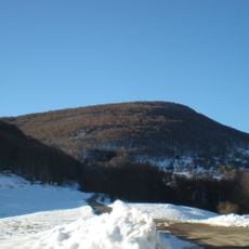
Farindola is a small mountain commune in the Abruzzo region, nestled at 530 meters elevation amid the peaks of the Gran Sasso e Monti della Laga National Park. The village sits on rolling terrain with stone buildings clustered together, typical of Apennine settlements.

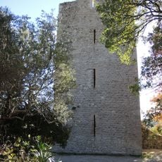
Evidence of human settlement in the area dates back to the Paleolithic period, though the community gained prominence in the 11th century when two significant Benedictine monasteries were established there. These religious centers shaped the region for centuries.

The residents of Farindola maintain their connection to Saint Nicholas of Bari through annual celebrations and traditional religious ceremonies throughout the year.

The nearest train station is at Bussi, approximately 28 kilometers away, while the regional airport is about 40 kilometers distant. Mountain roads connect the village to lower valleys, and the drive involves winding paths with scenic views along the ascent.

The Vitello d'Oro waterfall cascades near the village from a height of approximately 28 meters and remains largely overlooked by passing visitors. This natural feature tucked into the mountainous terrain offers a surprising reward for those who venture to find it.

Location: Province of Pescara

Capital city: Farindola

Elevation above the sea: 530 m

Shares border with: Castel del Monte, Penne, Villa Celiera, Arsita, Montebello di Bertona, Ofena

Address: 65010 Farindola, Province of Pescara, Italy

Website: http://comune.farindola.pe.it

GPS coordinates: 42.44179,13.82238

Latest update: December 20, 2025 12:35

Photos
Reviews

Visited this place? Tap the stars to rate it and share your experience / photos with the community! Try now! You can cancel it anytime.

« Farindola - Mountain commune in Province of Pescara, Italy » is provided by Around Us (aroundus.com). Images and texts are derived from Wikimedia project under a Creative Commons license. You are allowed to copy, distribute, and modify copies of this page, under the conditions set by the license, as long as this note is clearly visible.

Discover hidden gems everywhere you go!

From secret cafés to breathtaking viewpoints, skip the crowded tourist spots and find places that match your style. Our app makes it easy with voice search, smart filtering, route optimization, and insider tips from travelers worldwide. Download now for the complete mobile experience.

Around Us App Screenshot

A unique approach to discovering new places

Le Figaro

All the places worth exploring

France Info

A tailor-made excursion in just a few clicks

20 Minutes