Enable Location

We need your location to show you interesting places around you

Discover nearby places

Find interesting locations and hidden gems around you

Precise directions

Get accurate directions and distances to places

Your location is never shared with other users. It's only used when you tap the location button.

Sant'Agata de' Goti

Log in to your account

Start exploring — it's free

Trusted by 61,410 travelers worldwide

Continue with Google
Continue with Apple
or

We will send you a code to connect

By continuing, you accept our Terms and Conditions and our Privacy Policy

Check your inbox

We've sent a pincode in your inbox. Please enter the code below.

Sant'Agata de' Goti

Sant'Agata de' Goti, Municipality in Benevento Province, Italy.

Description

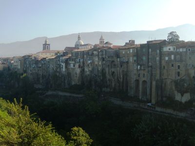
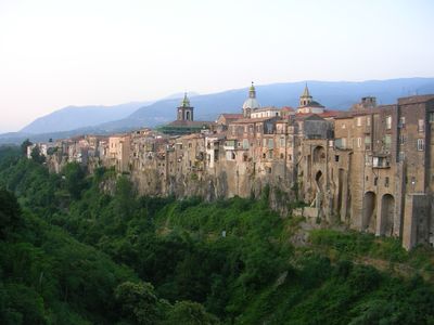
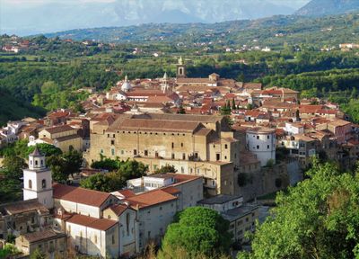
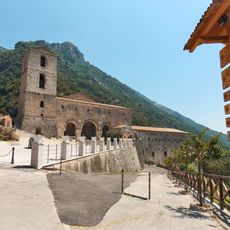
Sant'Agata de' Goti is a municipality perched on a hilltop between two ravines, defined by stone walls and steep terrain. The village spreads across this landscape with multiple churches, palaces, and narrow streets that reveal its medieval layout.

History

The settlement grew from the ancient Samnite town of Saticula and received its current name from the De Goth family in the 14th century. This ruling family left a lasting mark on the local structure and medieval development.

Culture

The village keeps its traditions alive through narrow streets and religious spaces that have shaped community life for centuries. The way locals use the steep pathways and gather in public squares for celebrations reveals how these places remain central to daily rhythms.

Practical

The village has steep streets and requires comfortable shoes for exploring; several marked paths connect the main attractions. It helps to arrive early in the day when temperatures are milder and pathways less crowded.

Did you know?

The Cathedral of the Assumption hides Roman structural remains beneath its foundations, revealing layers of past eras in one building. These hidden pieces remind visitors that people have inhabited this hilltop across thousands of years.

Elevation above the sea
156 m
Shares border with
Caserta, Dugenta, Frasso Telesino, Moiano, Santa Maria a Vico, Tocco Caudio, Valle di Maddaloni, Arienzo, Durazzano, Limatola
Address
Comune, Via Roma, 1, 82019 Sant'Agata Dé Goti BN
GPS coordinates
41.08932,14.49743
Latest update
December 14, 2025 18:19

AroundUs brings together thousands of curated places, local tips, and hidden gems, enriched daily by 60,000 contributors worldwide. Discover all places nearby (Province of Benevento).

« Sant'Agata de' Goti - Municipality in Benevento Province, Italy » is provided by Around Us (aroundus.com). Images and texts are derived from Wikimedia project under a Creative Commons license. You are allowed to copy, distribute, and modify copies of this page, under the conditions set by the license, as long as this note is clearly visible.

Discover hidden gems everywhere you go!

From secret cafés to breathtaking viewpoints, skip the crowded tourist spots and find places that match your style. Our app makes it easy with voice search, smart filtering, route optimization, and insider tips from travelers worldwide. Download now for the complete mobile experience.

Around Us App Screenshot

A unique approach to discovering new places

Le Figaro

All the places worth exploring

France Info

A tailor-made excursion in just a few clicks

20 Minutes

Around Us
Travel Guide & Maps
Download

Send to your phone

QR Code
1

Open the camera app on your mobile.

2

Point at the QR code with your camera. A notification will appear.

3

Tap the notification to open the link.