Montepagano, Medieval village in Roseto degli Abruzzi, Italy
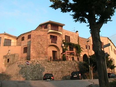
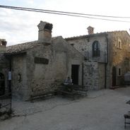
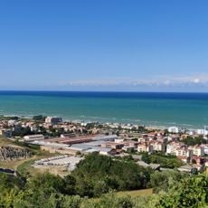
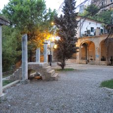
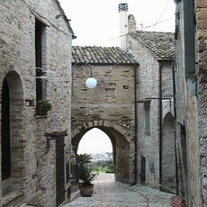
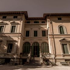
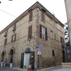
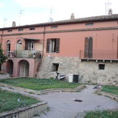
Montepagano is a settlement perched on a hilltop between the Vomano and Tordino rivers near Roseto degli Abruzzi at roughly 300 meters elevation. The village with its narrow lanes and stone buildings preserves a medieval layout and commands views toward the Adriatic coast.
The settlement emerged in the 11th century when inhabitants moved to higher ground to escape Turkish raids along the coast. This shift inland shaped how the place developed and where it stands today.
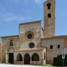
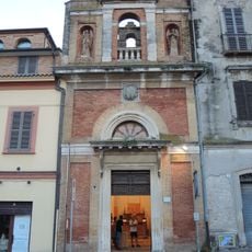
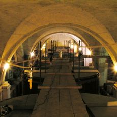
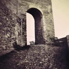
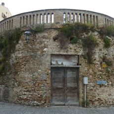
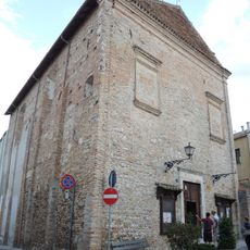
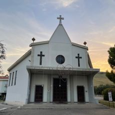
The Church of Santissima Annunziata from 1602 and three medieval gates define the village's layout and show how inhabitants organized their settlement over centuries. The central square with its historic entrances forms the heart of the place and reflects how the community developed over time.
The village is accessible by the SS80 road from Teramo or via historic walking paths from Roseto degli Abruzzi through surrounding countryside. Spring and fall offer the most comfortable conditions for exploring, as the weather is mild and the summer crowds thin out.
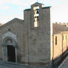
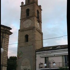
The bell tower in the central square stands on its own at 40 meters tall, separate from the church building itself. This detached arrangement is uncommon in Italian religious architecture and hints at the village's distinct building traditions.
Location: Roseto degli Abruzzi
GPS coordinates: 42.67682,13.98966
Latest update: December 6, 2025 16:04
Abruzzo brings together medieval villages, Roman sites, and mountain landscapes. Rocca Calascio rises to 1,460 meters (4,790 feet), offering views across the region from its ancient fortress walls. Gran Sasso and Majella national parks welcome hikers to explore trails through mountain terrain, where...
Chiesa di Santa Maria di Propezzano
6.8 km
Pineto Beach
8 km
Villa Clemente
1.8 km
Church of Santa Maria a Mare
7 km
Palazzo Bindi
8.7 km
San Gaetano
8.6 km
La spiaggia del Surabaja
2.7 km
Civic Plaster Cast Gallery "Raffaello Pagliaccetti"
8.6 km
Cantina Mazzarosa Devincenzi
2.9 km
Sala Bruno Buozzi
8.7 km
Anfiteatro Ennio Flaiano
8.2 km
Porta da Sole
141 m
Antico lavatoio pubblico
8.6 km
La vecchia distilleria
8.6 km
Torrione Il Bianco
8.7 km
Sant'Antonio
8.7 km
Monumento a Vittorio Emanuele II
8.6 km
Porta da Piedi
135 m
Monument to the fallen of the sea
2.9 km
Epigrafe della fondazione della Città di Giulia
8.7 km
Villa Mazzarosa Devincenzi
2.9 km
Giulianova lighthouses
8.8 km
Palazzo Roscioli
8.7 km
Palazzo Massei
8.8 km
Belvedere
8.6 km
Chiesa di San Francesco
8.5 km
Chiesa di Santa Maria
8.5 km
Campanile
174 mVisited this place? Tap the stars to rate it and share your experience / photos with the community! Try now! You can cancel it anytime.
Discover hidden gems everywhere you go!
From secret cafés to breathtaking viewpoints, skip the crowded tourist spots and find places that match your style. Our app makes it easy with voice search, smart filtering, route optimization, and insider tips from travelers worldwide. Download now for the complete mobile experience.
A unique approach to discovering new places❞
— Le Figaro
All the places worth exploring❞
— France Info
A tailor-made excursion in just a few clicks❞
— 20 Minutes