Pederfick, Mountain summit in South Tyrol, Italy
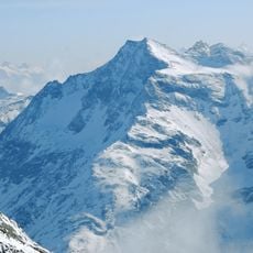
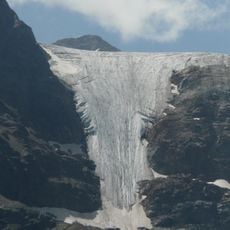
Pederfick (Italian: Pietrafitta) is a 3114 m summit in the Stiereckkamm ridge of the Laaser Berge, part of the Ortler Alps. It lies on the municipal boundary between Laas and Prad in the Vinschgau, South Tyrol, within Stilfserjoch National Park. To the north the mountain drops in a 350 m rock face onto a scree slope, bounded by the 2742 m Wasserfallspitze.
The summit lies on the municipal boundary between Laas and Prad in the Vinschgau, in the Italian province of South Tyrol, and forms part of Stilfsersjoch National Park. The German name Pederfick and the Italian Pietrafitta both refer to the same peak, which appears in Italian and German topographic maps of the Ortler group, such as Tabacco sheet 08 at 1:25,000.
The mountain carries two names: Pederfick in German and Pietrafitta in Italian, used on either side of the Laas and Prad municipal boundary that runs over the summit. The Italian name means "painted stone". The peak lies inside Stilfserjoch National Park, and the two usual starting points are the hamlets of Verklair and Außersulden.
Two main routes start low, at 1600–1900 m, so the 3114 m summit demands good fitness. From Verklair, follow the forest road, then trails 6A and 6B to the Gampenalm, continuing on trail 3 via the Verborgene Plais and Stiereck to a mildly exposed ridge. Alternatively start at Außersulden via trails 6, 22 or 22A to the Vellnairalm, then 3A to the Gampenalm.
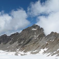
The north face drops 350 metres as a rock wall onto a scree slope, bounded east by a small ridge and north by the 2742 m Wasserfallspitze, a lower summit in front of the Pederfick. The mountain lies in the Stilfserjoch National Park, on the border between the municipalities of Laas and Prad.
The community of curious travelers
AroundUs brings together thousands of curated places, local tips, and hidden gems, enriched daily by 93,651 contributors worldwide.