Ratanakiri Province, Northeastern province of Cambodia.
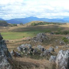
Ratanakiri is a province in northeastern Cambodia stretching along the borders with Laos and Vietnam, defined by dense forests, hilly terrain, and river systems that shape the landscape. The land varies between elevated plateaus and deep river valleys carved by multiple waterways flowing through the region.
The province was created in 1959 from territories of the neighboring Stung Treng Province, establishing itself as an independent administrative unit. In the following decades, the region became strategically important to the nation's political trajectory and development.
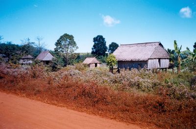
The indigenous Khmer Loeu communities in this region maintain their own traditions and craft techniques that remain visible in daily village life. Visitors encounter people who manage their land according to generations-old patterns and celebrate their seasons within the forest rhythms.
Flying from Phnom Penh to Banlung is the fastest way to reach the province, though bus routes are also available but require more travel time. The dry season from November to April offers the best conditions for getting around on roads and trails.
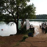
Yeak Laom Lake was formed roughly 700,000 years ago through volcanic activity and sits surrounded by tropical rainforest. The lake holds sacred meaning for local communities and remains a quiet water body within dense green growth.
The community of curious travelers
AroundUs brings together thousands of curated places, local tips, and hidden gems, enriched daily by 60,000 contributors worldwide.