Ch'ŏnwang-bong, Berggipfel in Südkorea
Location: South Chungcheong
GPS coordinates: 36.34750,127.22310
Latest update: November 14, 2025 16:52
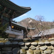
Donghaksa Temple
703 m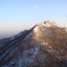
Gyeryongsan National Park
1.9 km
Sujŏng-bong (tumoy sa bukid sa Habagatang Korea, Chungcheongnam-do, lat 36,37, long 127,21)
2.6 km
Amyongch'u-p'okp'o
1.9 km
Ch'igae-bong
1.6 km
Ssalgae-bong
1.7 km
Ch'ŏnhwang-bong (tumoy sa bukid sa Habagatang Korea)
1.6 km
Ŭnsŏn-p'okp'o
1.4 km
Changgun-bong (tumoy sa bukid sa Habagatang Korea, Chungcheongnam-do)
3.5 km
Sinsŏn-bong (tumoy sa bukid sa Habagatang Korea, Chungcheongnam-do)
2.3 km
Yŏnch'ŏn-bong
2.5 km
Yongmun-p'okp'o
3.5 km
Hwangjŏk-pong
807 m
Kwanŭm-bong
2.1 km
은선폭포
1.4 km
Scenic viewpoint
1.9 km
Scenic viewpoint
2.9 km
Scenic viewpoint
2 km
Scenic viewpoint
3.4 km
Scenic viewpoint
1.9 km
Scenic viewpoint
1.9 km
Scenic viewpoint
1.3 km
Scenic viewpoint
3 km
남매탑
1.9 km
대자암
3.3 km
남매탑
1.9 km
Waterfall
3.3 km
은선폭포
1.4 kmReviews
Visited this place? Tap the stars to rate it and share your experience / photos with the community! Try now! You can cancel it anytime.
Discover hidden gems everywhere you go!
From secret cafés to breathtaking viewpoints, skip the crowded tourist spots and find places that match your style. Our app makes it easy with voice search, smart filtering, route optimization, and insider tips from travelers worldwide. Download now for the complete mobile experience.

A unique approach to discovering new places❞
— Le Figaro
All the places worth exploring❞
— France Info
A tailor-made excursion in just a few clicks❞
— 20 Minutes