Aksu-Zhabagly Nature Reserve, Nature reserve in Turkistan Region, Kazakhstan.
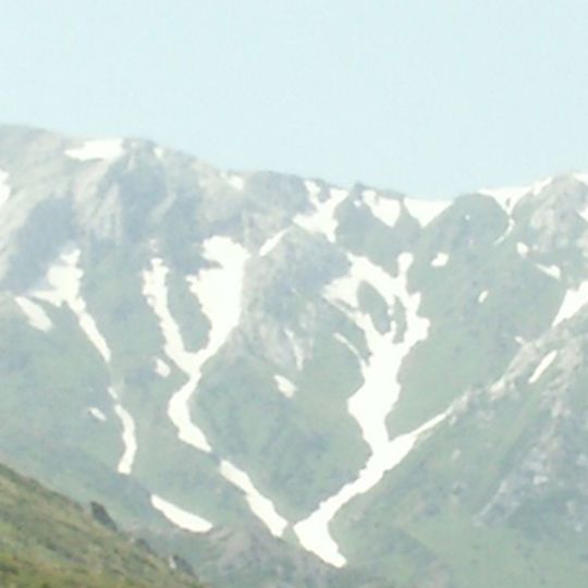
Aksu-Zhabagly Nature Reserve covers 131,934 hectares on the northwestern end of the Talas Alatau and the adjacent Ugam range, from 1,000 to 4,280 metres. The Aksu river cuts a canyon about 500 metres deep between bare pale grey-green slopes streaked with snow and ridges of vertically striated rock. A V-shaped valley with a narrow blue-green stream opens toward distant scree fields.
The reserve was created by decrees of the Council of People's Commissars of the Kazakh ASSR on 14 July 1926 and of the RSFSR on 27 May 1927, initially covering 30,545 hectares. In 1929 the Aksu river canyon was added, and in 1935 the area grew to 48,570 hectares with the Baldybrek valleys. It was inscribed on the UNESCO World Heritage list on 12 June 2015.
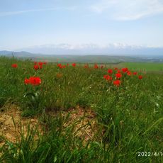
The reserve is named after the Aksu and Zhabagly rivers, which bound it on either side. Its emblem is the Greig tulip, whose crimson petals reach 12–15 cm and which was once collected for export. A visitor centre with a nature museum presents the reserve and its ecological trail routes.
The visitor centre holds a nature museum with information on the reserve and its ecological trail routes. The reserve spans elevations from 1,000 to 4,280 metres, so lower valleys and high ridges differ sharply in snow cover and access. The Karabastau and Aulie palaeontological plots lie about 120 km north-west of the main territory on the Boroldai range.
The reserve's emblem is Greig's tulip, whose crimson petals measure 12 to 15 cm and were once collected for export. At around 3,000 m, inaccessible rock faces hold a gallery of petroglyphs showing houses, wild animals and hunting scenes. Palaeontologists have also found fossilised plants, insects, fish and lizards in the reserve's clay soils.
The community of curious travelers
AroundUs brings together thousands of curated places, local tips, and hidden gems, enriched daily by 93,331 contributors worldwide.