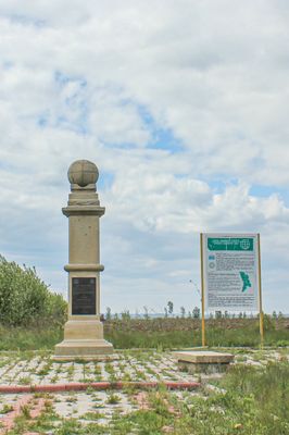
Rudi Geodetic Point, Scientific monument in Rudi, Moldova
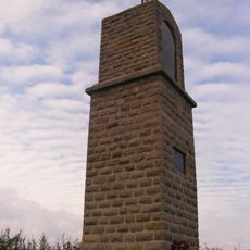
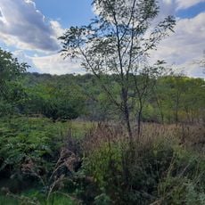
The Rudi Geodetic Point is a scientific monument in the village of Rudi, marked by a commemorative obelisk that stands in an apple orchard. The structure marks one station in a chain of measurement points that once stretched across Eastern Europe from the north to the Black Sea coast.
This measuring point was established in 1847 by Friedrich Georg Wilhelm von Struve as part of his ambitious project to determine Earth's exact dimensions. The surveying network that included this station contributed to early scientific understanding of the planet's shape and size.
The site represents international scientific collaboration between the Russian Empire and Sweden-Norway, demonstrating early cross-border research initiatives.
You can reach the obelisk by walking along a brick path from the main road, and parking is available near the measurement station. Comfortable shoes are recommended since the site sits in an orchard with unpaved surroundings.
This obelisk stands in the middle of an apple orchard and is one of 265 original geodetic vertices that together made the first precise measurement of a meridian possible. The points reveal how early scientists coordinated efforts across different regions and political boundaries.
The community of curious travelers
AroundUs brings together thousands of curated places, local tips, and hidden gems, enriched daily by 60,000 contributors worldwide.