Enable Location

We need your location to show you interesting places around you

Discover nearby places

Find interesting locations and hidden gems around you

Precise directions

Get accurate directions and distances to places

Your location is never shared with other users. It's only used when you tap the location button.

Noorderhoofd

Log in to your account

Start exploring — it's free

Trusted by 63,153 travelers worldwide

Continue with Google
Continue with Apple
or

We will send you a code to connect

By continuing, you accept our Terms and Conditions and our Privacy Policy

Check your inbox

We've sent a pincode in your inbox. Please enter the code below.

Noorderhoofd
Discussion Reviews 3 Photos
1.6k Popularity

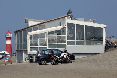
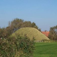
Noorderhoofd, Maritime navigation structure in Westkapelle, Netherlands.

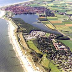
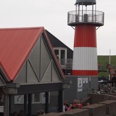
Noorderhoofd is a lighthouse in Westkapelle with a red tower marked by a white band running across its shaft. The structure stands approximately 16 meters high and emits light signals to assist ships in navigation.

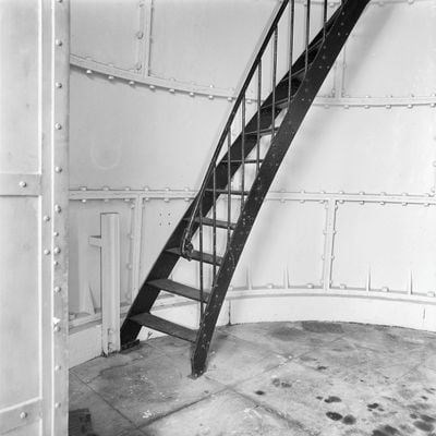
The lighthouse was built in 1874 and represented a pioneering work by Dutch architect Quirinus Harder. Its round cast iron design was innovative for the Netherlands when it was completed.

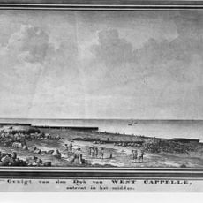
The lighthouse served as part of a navigation network that guided ships through waters around Walcheren. Together with nearby lighthouses, it formed a system that mariners relied on to travel safely through the region.

The lighthouse is accessible to visitors who can explore all four floors inside. The area around the structure is generally easy to reach, though it is wise to check opening hours before your visit.

The round iron segments of the tower were cast using special wooden molds created by the Nering Bogel foundry in Deventer. This manufacturing technique made it possible to build the curved iron shell.

The community of curious travelers

AroundUs brings together thousands of curated places, local tips, and hidden gems, enriched daily by 60,000 contributors worldwide.

Start exploring
Location
Inception
1875
Architects
Quirinus Harder
Floors above the ground
4
Height
18 m
Made from material
cast iron
Address
Zeedijk 5
GPS coordinates
51.54009,3.43687
Latest update
December 21, 2025 21:27
Around this place
Show the full map
Reviews
Share your experience

No review yet

Discussions
Start a discussion...

No discussion yet

« Noorderhoofd - Maritime navigation structure in Westkapelle, Netherlands » is provided by Around Us (aroundus.com). Images and texts are derived from Wikimedia project under a Creative Commons license. You are allowed to copy, distribute, and modify copies of this page, under the conditions set by the license, as long as this note is clearly visible.

Discover hidden gems everywhere you go!

From secret cafés to breathtaking viewpoints, skip the crowded tourist spots and find places that match your style. Our app makes it easy with voice search, smart filtering, route optimization, and insider tips from travelers worldwide. Download now for the complete mobile experience.

Around Us App Screenshot

A unique approach to discovering new places

Le Figaro

All the places worth exploring

France Info

A tailor-made excursion in just a few clicks

20 Minutes

Around Us
Travel Guide & Maps
Download

Send to your phone

QR Code
1

Open the camera app on your mobile.

2

Point at the QR code with your camera. A notification will appear.

3

Tap the notification to open the link.