Haringvlietdam

Log in to your account

AroundUs is a community-driven map of interesting places, built by curious explorers like you. It grows with every review, story, and photo you share.
Connect to save your favorite spots, contribute locations, and create personalized routes.
Continue with Google
Continue with Apple
Continue with X
Continue with Facebook
Continue with email
By continuing, you accept our Terms and Conditions and our Privacy Policy
Create an account
Add to collection
Map
Suggest a change
Share

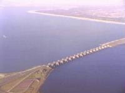
Haringvlietdam, Dam and lock complex in South Holland, Netherlands.

The Haringvlietdam is a combined dam and lock structure in South Holland that stretches across the estuary and separates the North Sea from the inland waterways. The construction includes a road crossing the top and a series of moveable gates arranged in parallel to control water levels.

The structure was built between 1957 and 1971 as part of the Delta Works program created after the 1953 floods to protect against storm surge. It was the sixth major project of this protection system that reshaped South Holland's landscape.

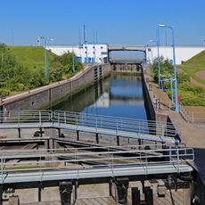
The dam shows how the Dutch have mastered the challenge of living with water through large-scale engineering projects visible in the landscape. Walking across it, you witness a place where managing water flows became a source of national pride and skill.

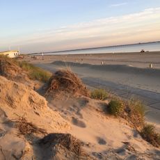
The road over the structure connects two islands and gives visitors views of the water and surrounding landscape as you cross. Driving slowly or stopping allows you to observe the scale and see the water flowing through the gates.

Hidden within the structure are fish passages built into the piers that allow migrating fish to swim between the sea and inland waters even when the main gates are closed. This overlooked feature shows how engineering and nature coexist in the design.

Location: Goeree-Overflakkee

Location: Voorne aan Zee

Inception: 1964

Architectural style: reconstruction-period architecture

Made from material: concrete

Part of: Delta Works, Beschermingsprogramma Wederopbouw 1959-1965

Address: Haringvliet, tussen Stellendam en Hellevoetsluis te HELLEVOETSLUIS

GPS coordinates: 51.83278,4.04972

Latest update: December 8, 2025 19:57

Photos
Reviews

Visited this place? Tap the stars to rate it and share your experience / photos with the community! Try now! You can cancel it anytime.

« Haringvlietdam - Dam and lock complex in South Holland, Netherlands » is provided by Around Us (aroundus.com). Images and texts are derived from Wikimedia project under a Creative Commons license. You are allowed to copy, distribute, and modify copies of this page, under the conditions set by the license, as long as this note is clearly visible.

Discover hidden gems everywhere you go!

From secret cafés to breathtaking viewpoints, skip the crowded tourist spots and find places that match your style. Our app makes it easy with voice search, smart filtering, route optimization, and insider tips from travelers worldwide. Download now for the complete mobile experience.

Around Us App Screenshot

A unique approach to discovering new places

Le Figaro

All the places worth exploring

France Info

A tailor-made excursion in just a few clicks

20 Minutes