Chest opened
+${chestReward.xp} XP
Explorer
NOUVEAU ×${chestReward.collectible.quantity}
tapez pour fermer
Chest locked

Open chests in the app

Around Us is built for your phone — chests unlock when you walk, explore and capture nearby places.

Enable Location

We need your location to show you interesting places around you

Discover nearby places

Find interesting locations and hidden gems around you

Precise directions

Get accurate directions and distances to places

Your location is never shared with other users. It's only used when you tap the location button.

Log in to your account

Start exploring — it's free

Trusted by 72,878 travelers worldwide

Continue with Google
Continue with Apple
or

We will send you a code to connect

By continuing, you accept our Terms and Conditions and our Privacy Policy

Check your inbox

We've sent a pincode in your inbox. Please enter the code below.

Markdal
Discussion Reviews Photo
1.8k Popularity

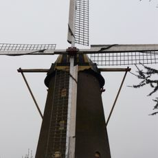
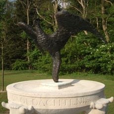
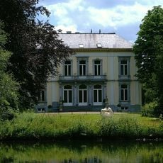
Markdal, Nature area near Breda, Netherlands

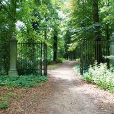
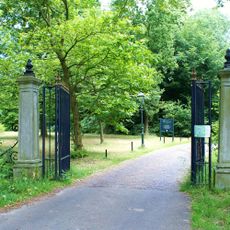
Markdal is a nature area that follows the Mark River, combining wetlands, meadows, and forests into one interconnected landscape. A network of walking and cycling paths winds through the terrain, connecting different parts of the area.

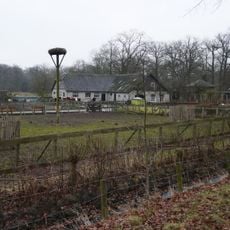
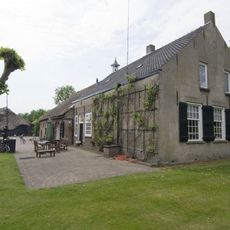
The area was once dominated by farming practices until restoration efforts transformed it. The Mark River was reshaped to follow a natural meandering course, which reduced flood risks while creating new habitats.

The area holds special meaning for locals who have witnessed its transformation from neglected farmland into a thriving ecosystem. Today, visitors can see how the community values this green space as part of Breda's identity.

The area works best for walking or cycling, with paths designed for both activities. Morning visits are rewarding for birdwatching and offer cooler temperatures during warm seasons.

Controlled flooding zones have been deliberately created in parts of the area to give the river more space. This design allows water to spread safely during high flows without threatening nearby towns.

The community of curious travelers

AroundUs brings together thousands of curated places, local tips, and hidden gems, enriched daily by 60,000 contributors worldwide.

Start exploring
Location
GPS coordinates
51.55214,4.79150
Latest update
December 14, 2025 12:25
Around this place
Kasteel Bouvigne
Netherlands

Kasteel Bouvigne

1.3 km
Heemkundig Museum Paulus van Daesdonck
Netherlands

Heemkundig Museum Paulus van Daesdonck

798 m
Sint-Laurentiuskerk
Netherlands

Sint-Laurentiuskerk

347 m
Slot Grimhuijsen
Netherlands

Slot Grimhuijsen

319 m
De Korenbloem
Netherlands

De Korenbloem

837 m
Bezoekerscentrum Wolfslaar
Netherlands

Bezoekerscentrum Wolfslaar

1.2 km
Wagenschuur onder dwars rieten schilddak
Netherlands

Wagenschuur onder dwars rieten schilddak

1.4 km
Oude Beekhoek: bakhuis
Netherlands

Oude Beekhoek: bakhuis

1.3 km
Oorlogsmonument Nieuw-Ginneken
Netherlands

Oorlogsmonument Nieuw-Ginneken

655 m
Huis Wolfslaar
Netherlands

Huis Wolfslaar

1.3 km
Huis Wolfslaar: hek bij de achteringang van het park
Netherlands

Huis Wolfslaar: hek bij de achteringang van het park

1.3 km
Oude Beekhoek: waterput met boom en putmik
Netherlands

Oude Beekhoek: waterput met boom en putmik

1.3 km
Oude Beekhoek, Breda
Netherlands

Oude Beekhoek, Breda

1.3 km
Pastorie, Sint-Laurentiuskerk (Ulvenhout)
Netherlands

Pastorie, Sint-Laurentiuskerk (Ulvenhout)

352 m
Woonhuis
Netherlands

Woonhuis

627 m
Boerderij van het Kempische langgeveltype, met drie schuren en een bakhuis
Netherlands

Boerderij van het Kempische langgeveltype, met drie schuren en een bakhuis

551 m
Schoenmakershuis
Netherlands

Schoenmakershuis

430 m
Dorpstraat 52, Ulvenhout
Netherlands

Dorpstraat 52, Ulvenhout

418 m
Oude Beekhoek: Vlaamse schuur
Netherlands

Oude Beekhoek: Vlaamse schuur

1.3 km
Voormalige elektriciteitscentrale annex drinkwaterleidingbedrijf met daarin dienstwoning, kantoor, werkplaats en bergplaats, nu drie woningen met werkplaats en bergplaats
Netherlands

Voormalige elektriciteitscentrale annex drinkwaterleidingbedrijf met daarin dienstwoning, kantoor, werkplaats en bergplaats, nu drie woningen met werkplaats en bergplaats

975 m
Huis Wolfslaar: ijskelder
Netherlands

Huis Wolfslaar: ijskelder

1.3 km
Galderseweg 79, Breda
Netherlands

Galderseweg 79, Breda

927 m
Boerderij van het Kempische langgeveltype met bakhuis en twee schuren
Netherlands

Boerderij van het Kempische langgeveltype met bakhuis en twee schuren

290 m
Reeptiend 50, Breda
Netherlands

Reeptiend 50, Breda

428 m
Villa Mon Plaisir
Netherlands

Villa Mon Plaisir

1.3 km
Huis Wolfslaar: hek bij de hoofdingang van het park
Netherlands

Huis Wolfslaar: hek bij de hoofdingang van het park

1.3 km
Natuurstenen hekpalen met renaissance-ornament
Netherlands

Natuurstenen hekpalen met renaissance-ornament

369 m
Kasteel
Netherlands

Kasteel

1.2 km
Show the full map
Reviews
Share your experience

No review yet

Discussions
Start a discussion...

No discussion yet

« Markdal - Nature area near Breda, Netherlands » is provided by Around Us (aroundus.com). Images and texts are derived from Wikimedia project under a Creative Commons license. You are allowed to copy, distribute, and modify copies of this page, under the conditions set by the license, as long as this note is clearly visible.

Discover hidden gems everywhere you go!

From secret cafés to breathtaking viewpoints, skip the crowded tourist spots and find places that match your style. Our app makes it easy with voice search, smart filtering, route optimization, and insider tips from travelers worldwide. Download now for the complete mobile experience.

Around Us App Screenshot

A unique approach to discovering new places

Le Figaro

All the places worth exploring

France Info

A tailor-made excursion in just a few clicks

20 Minutes

Around Us
Travel Guide & Maps
Download

Send to your phone

QR Code
1

Open the camera app on your mobile.

2

Point at the QR code with your camera. A notification will appear.

3

Tap the notification to open the link.