Calandbrug, Vertical-lift bridge in Botlek, Netherlands
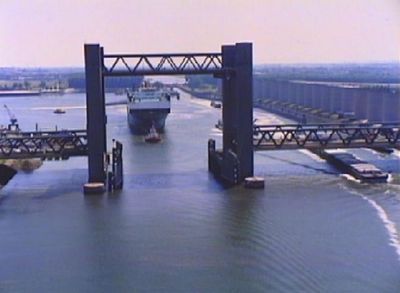
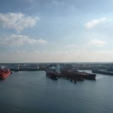
The Calandbrug is a road bridge with lifting towers in Rotterdam that spans the Caland Canal in an industrial area. The steel structure has a movable roadway that lifts up to allow ships to pass underneath.
The bridge opened in 1969 and was originally built to handle both rail and road traffic as part of the harbor's transportation network. In 2021, train services moved to a new route, leaving the bridge for road use only.
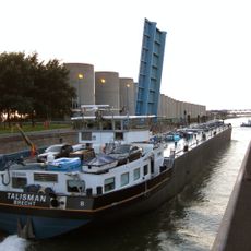
The bridge is woven into the daily routines of port workers and continues to shape the industrial harbor's character. You see trucks and ships moving through here constantly, making it a busy junction in the port's operations.
Vehicles carrying hazardous materials are required to use this route as it provides a safer passage across the canal. Drivers should be prepared for occasional closures when the lifting mechanism operates to let ships pass.
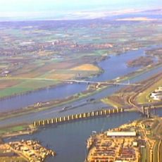
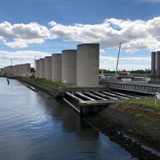
A 1750-meter-long windscreen lines the southern side of the canal and protects ships from crosswinds as they pass under the bridge. This feature is especially important during rough weather and is often overlooked despite being a key safety element.
Location: Rotterdam
Length: 344 m
GPS coordinates: 51.90139,4.22694
Latest update: December 7, 2025 20:26
Harmsenbrug
1.1 km
Brielse meer
2.6 km
Rozenburg wind wall
237 m
Rozenburgsesluis
935 m
Mr. Dr. C.P. Zaayer Pumping Station
2.6 km
Zevende Petroleumhaven
2.7 km
Joodse begraafplaats van Maassluis
2.6 km
De Hoop
2.8 km
De Hoop
1.6 km
Elbe
2.2 km
Railway bridge Maassluis
2.4 km
Ontmoetingskerk
1.4 km
Lezend meisje
1.4 km
Martinuskerk, Zwartewaal
2 km
Immanuel Church
1.8 km
Untitled
1.6 km
Koepaardbrug
2.5 km
Vloedpaal
2.5 km
't Oude Jachthuis, gebouwd in 1889, oorspronkelijk met één gemetselde bouwlaag en direct daarop de kap.
1.4 km
Nettenpakhuis
2.2 km
Monument voor Hendrik Goudappel
1.8 km
Monument aan de Meeldijk
2.4 km
In oorsprong ten behoeve van de naastgelegen korenmolen 'de Hoop' gebouwde molenaarswoning, bestaande uit een verdiepingloos pand onder met blauwe pannen gedekt zadeldak tussen tuitgevels.
1.6 km
Herdenkingsmonument
2.8 km
Oorlogsmonument
2.7 km
De Zaayer, Maassluis
2.5 km
Vrijheidsbos
2.5 km
Oorlogsmonument
1.8 kmVisited this place? Tap the stars to rate it and share your experience / photos with the community! Try now! You can cancel it anytime.
Discover hidden gems everywhere you go!
From secret cafés to breathtaking viewpoints, skip the crowded tourist spots and find places that match your style. Our app makes it easy with voice search, smart filtering, route optimization, and insider tips from travelers worldwide. Download now for the complete mobile experience.
A unique approach to discovering new places❞
— Le Figaro
All the places worth exploring❞
— France Info
A tailor-made excursion in just a few clicks❞
— 20 Minutes