Enable Location

We need your location to show you interesting places around you

Discover nearby places

Find interesting locations and hidden gems around you

Precise directions

Get accurate directions and distances to places

Your location is never shared with other users. It's only used when you tap the location button.

Log in to your account

Join the adventure

Create your free account and start exploring (like 60k+ others)

We will send you a code to connect

or
Continue with Google
Continue with Apple
By continuing, you accept our Terms and Conditions and our Privacy Policy

Check your inbox

We've sent a pincode in your inbox. Please enter the code below.

Tuitjenhorn, Rural settlement in North Holland, Netherlands.

Description

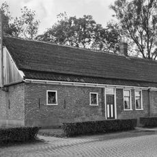
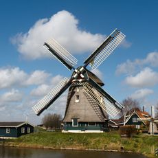
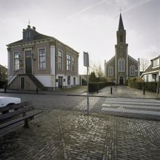
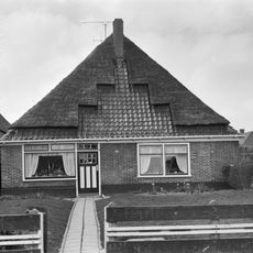
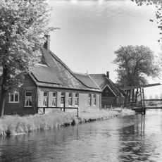
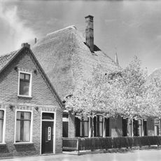
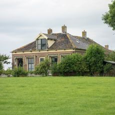
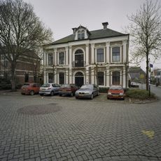
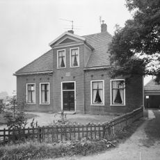
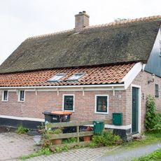
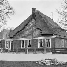
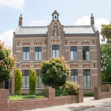
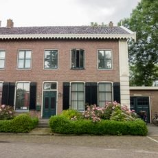
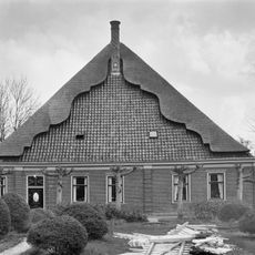
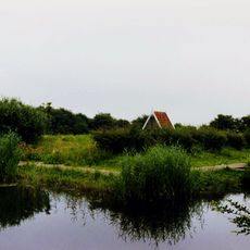
Tuitjenhorn is a rural settlement in North Holland that extends along dike structures across flat agricultural land at sea level. The village consists mostly of residential properties typical of the Dutch countryside, with simple buildings arranged along a quiet landscape.

History

The settlement received its first written mention between 1280 and 1287 under the name 'van tutinghehorne' and developed into a central village of Harenkarspel municipality. These early origins show how the location became established as an important point in the region's administrative landscape.

Culture

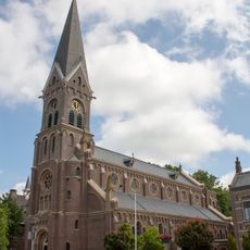
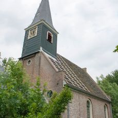
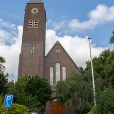
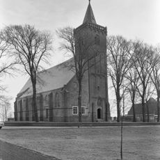
The St. Jacobus de Meerdere Church stands at the heart of the settlement with its blend of older and newer architectural elements reflecting construction across different periods. Visitors notice how this building anchors the village landscape and serves as a visual reference point when moving through the area.

Practical

The location lies on level ground and is easy to walk around, with the flat Dutch landscape making travel on foot straightforward. Visitors find a quiet village without crowds, allowing for a relaxed exploration of the area.

Did you know?

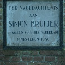
The village was home to Gerard Kuiper, a major astronomer of the 20th century who made important contributions to planetary research. Though not widely known today, this scientific connection is part of the local story and shows how small places can produce influential thinkers.

Location
GPS coordinates
52.73333,4.75000
Latest update
December 7, 2025 20:47

AroundUs brings together thousands of curated places, local tips, and hidden gems, enriched daily by 60,000 contributors worldwide. Discover all places nearby (Schagen).

Around this place
Van Blanckendaell Park
Netherlands

Van Blanckendaell Park

604 m
Kalverdijk
Netherlands

Kalverdijk

1.2 km
Ursulakerk, Warmenhuizen
Netherlands

Ursulakerk, Warmenhuizen

1.2 km
Ursula en Gezelinnen, Warmenhuizen
Netherlands

Ursula en Gezelinnen, Warmenhuizen

1.5 km
Molen van Piet
Netherlands

Molen van Piet

642 m
Nederlands Hervormde Kerk (Eenigenburg)
Netherlands

Nederlands Hervormde Kerk (Eenigenburg)

2.1 km
De Groenvelder
Netherlands

De Groenvelder

3.9 km
Nederlands Hervormde Kerk
Netherlands

Nederlands Hervormde Kerk

2.6 km
Heilige Jacobus de Meerderekerk
Netherlands

Heilige Jacobus de Meerderekerk

623 m
Monument voor Simon Kruijer
Netherlands

Monument voor Simon Kruijer

770 m
Gereformeerde Kerk
Netherlands

Gereformeerde Kerk

2.2 km
Oorlogsmonument
Netherlands

Oorlogsmonument

1.4 km
Raadhuis Dirkshorn
Netherlands

Raadhuis Dirkshorn

2.6 km
Stolphoeve, ook van belang in samenhang met nr 207
Netherlands

Stolphoeve, ook van belang in samenhang met nr 207

1.7 km
Raadhuisstraat 34, Dirkshorn
Netherlands

Raadhuisstraat 34, Dirkshorn

2.5 km
Dorpsstraat 14, Dirkshorn
Netherlands

Dorpsstraat 14, Dirkshorn

2.6 km
Schoolgebouw annex Onderwijzerswoning
Netherlands

Schoolgebouw annex Onderwijzerswoning

2.1 km
Voormalig gemeentehuis annex secretariswoning van de vroegere gemeente Warmenhuizen
Netherlands

Voormalig gemeentehuis annex secretariswoning van de vroegere gemeente Warmenhuizen

1.5 km
Hervormde pastorie
Netherlands

Hervormde pastorie

2.1 km
Voormalige landarbeiderswoning
Netherlands

Voormalige landarbeiderswoning

2.1 km
Stolphoeve met links een uitbouwtje onder een met leien gedekt schilddak. Zesruitsschuifvensters
Netherlands

Stolphoeve met links een uitbouwtje onder een met leien gedekt schilddak. Zesruitsschuifvensters

998 m
Pastorie
Netherlands

Pastorie

1.6 km
Voormalige vrijstaande pastorie in eclectische bouwtrant
Netherlands

Voormalige vrijstaande pastorie in eclectische bouwtrant

1.1 km
Bakstenen toiletgebouwtje
Netherlands

Bakstenen toiletgebouwtje

2.1 km
Vliegersmonument
Netherlands

Vliegersmonument

2.6 km
Stolphoeve. Het voorgevelvlak wordt geleed door geblokte lisenen en horizontaal afgesloten door een kroonlijst. Gesneden voordeur en bovenlicht
Netherlands

Stolphoeve. Het voorgevelvlak wordt geleed door geblokte lisenen en horizontaal afgesloten door een kroonlijst. Gesneden voordeur en bovenlicht

1.7 km
Toren van de Ursulakerk
Netherlands

Toren van de Ursulakerk

1.2 km
Kasteel Nieuwendoorn
Netherlands

Kasteel Nieuwendoorn

2.2 km
Show the full map
« Tuitjenhorn - Rural settlement in North Holland, Netherlands » is provided by Around Us (aroundus.com). Images and texts are derived from Wikimedia project under a Creative Commons license. You are allowed to copy, distribute, and modify copies of this page, under the conditions set by the license, as long as this note is clearly visible.

Discover hidden gems everywhere you go!

From secret cafés to breathtaking viewpoints, skip the crowded tourist spots and find places that match your style. Our app makes it easy with voice search, smart filtering, route optimization, and insider tips from travelers worldwide. Download now for the complete mobile experience.

Around Us App Screenshot

A unique approach to discovering new places

Le Figaro

All the places worth exploring

France Info

A tailor-made excursion in just a few clicks

20 Minutes

Around Us
Travel Guide & Maps
Download

Send to your phone

QR Code
1

Open the camera app on your mobile.

2

Point at the QR code with your camera. A notification will appear.

3

Tap the notification to open the link.