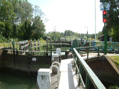
Helsluis, Historical lock in Dordrecht, Netherlands
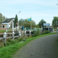
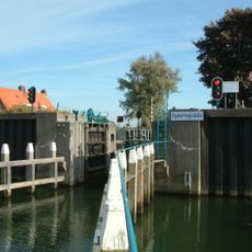
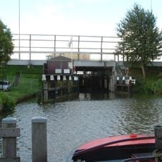
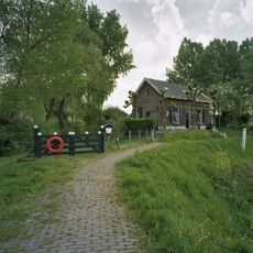
Helsluis is a lock in Dordrecht that connects two river sections and features a lens-shaped chamber with sloping quay walls lined with basalt blocks. Wooden structures at both ends help stabilize this navigational passage.
Built in 1864, this lock became part of a water management system connecting formerly separate polders in the region. It served as a crucial link in controlling water levels across the Dutch landscape.
This Rijksmonument exemplifies Dutch water management engineering through its preserved manual operation systems and traditional construction methods.
The lock operates using manual mechanisms to control water levels between the two rivers, with gates and a rolling bridge still worked by hand. You can observe the structure from nearby paths that run along the water.
A double water gauge on site marks the flood level from February 1953, when a devastating flood submerged large areas of the country. This marker stands as a reminder of one of the Netherlands' worst water disasters.
Location: Dordrecht
Part of: Sluiscomplex Hel- en Zuilespolder
Address: Merwelanden bij 33
GPS coordinates: 51.81072,4.78244
Latest update: December 14, 2025 18:01
Hollandse Biesbosch
3.9 km
Baanhoekbrug
3.1 km
Sliedrechtse Biesbosch
1.6 km
Ottersluis
2.4 km
Beth-El Church (Sliedrecht)
1.2 km
National Dredging Museum
2.4 km
Spieringsluis
3.9 km
Peulensluis
3.3 km
Watertoren (Sliedrecht)
1.6 km
Public Observatory Mercury
1.1 km
Onze-Lieve-Vrouw van Altijddurende Bijstandkerk (Sliedrecht)
1.9 km
Nederlands Hervormde Kerk, Wijgaarden
4 km
Raadhuis
1.4 km
Nederlands Hervormde Kerk (Sliedrecht)
1.5 km
Rivierdijk 470, Sliedrecht
642 m
Kerkbuurt 99, Sliedrecht
1.3 km
Merwelanden 33, Dordrecht
15 m
Monument Merwedegijzelaars
1.2 km
Plaquette voor Merwedegijzelaars
1.5 km
Oorlogsmonument
1.5 km
Crescent
2.2 km
Woonhuis van het type dijkhuis gebouwd in Traditioneel Ambachtelijke stijl met elementen uit het Classicisme
2.4 km
Nationaal Baggermuseum
2.3 km
Boerderij van het dwarsdeeltype met een T-vormige plattegrond. Het pand is gebouwd in Traditioneel Ambachtelijke stijl
3.2 km
Pand met kapverdieping onder pannen zadeldak
4 km
Crossline-monument
844 m
Gedenksteen van het Rode Kruis
1.5 km
Indië-monument
1.5 kmVisited this place? Tap the stars to rate it and share your experience / photos with the community! Try now! You can cancel it anytime.
Discover hidden gems everywhere you go!
From secret cafés to breathtaking viewpoints, skip the crowded tourist spots and find places that match your style. Our app makes it easy with voice search, smart filtering, route optimization, and insider tips from travelers worldwide. Download now for the complete mobile experience.
A unique approach to discovering new places❞
— Le Figaro
All the places worth exploring❞
— France Info
A tailor-made excursion in just a few clicks❞
— 20 Minutes