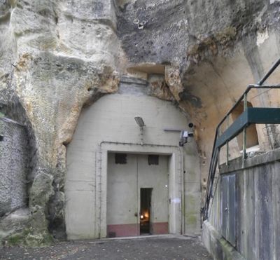
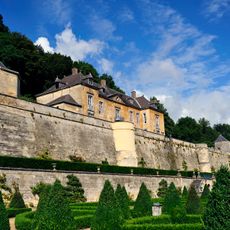
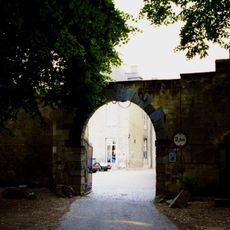
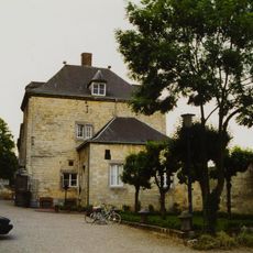
NORTHAG War Headquarters Cannerberg, NATO bunker complex in Maastricht, Netherlands
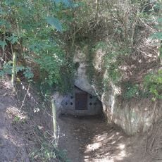
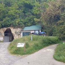
NORTHAG War Headquarters is an underground military facility carved into the limestone caves beneath Cannerberg mountain, with a network of tunnels connecting various operations centers. The restored complex contains offices, map rooms, and control stations that once monitored military activities across the region.
The facility opened in 1955 as NATO's Joint Operations Centre, coordinating military activities across northern West Germany during the Cold War. Operations ceased in 1992 following the end of the conflict.
The bunker embodied NATO cooperation, bringing together personnel from the Netherlands, Britain, Belgium, Germany, and the United States under one roof. This international presence remains visible today through the restored workspaces that show how these nations coordinated their efforts.
Guided tours lasting about two hours lead visitors through the underground complex, and wearing warm clothing and sturdy shoes is essential since temperatures stay cool year-round. The passages have steep stairs and tight spaces, so proper footwear is important for both safety and comfort.
The facility houses a contemporary art exhibition called 'Shelter' by Rob Scholte, featuring a work titled N8W8 that reinterprets Rembrandt's famous Night Watch painting. This unexpected blend of art and military history offers a surprising perspective on the site.
Location: Maastricht
GPS coordinates: 50.82224,5.66456
Latest update: December 8, 2025 13:40
Château Neercanne
454 m
Jezuïetenberg
105 m
Smokkelmolen
668 m
Fallenberggroeve
277 m
Heilig-Grafkapel, Nederkanne
653 m
Belgium-Netherlands boundary stone no. 72
572 m
Belgium-Netherlands boundary stone no. 69
603 m
Belgium-Netherlands boundary stone no. 76
632 m
Belgium-Netherlands boundary stone no. 71
563 m
Belgium-Netherlands boundary stone no. 75
579 m
Château Neercanne: main building
440 m
Château Neercanne: park and gardens
439 m
Château Neercanne: terrace wall with terrace
416 m
Belgium-Netherlands boundary stone no. 75a
659 m
Château Neercanne: defensive wall with corner tower and arbor
409 m
Douanekantoor-tramstation Neder-Can
276 m
Belgium-Netherlands boundary stone no. 66
662 m
Château Neercanne: gatehouse and farm
439 m
Belgium-Netherlands boundary stone no. 74
675 m
Belgium-Netherlands boundary stone no. 70b
581 m
Château Neercanne: outbuilding with quarry with north gate
418 m
Belgium-Netherlands boundary stone no. 71a
475 m
Belgium-Netherlands boundary stone no. 67
601 m
Belgium-Netherlands boundary stone no. 70a
562 m
Belgium-Netherlands boundary stone no. 69a
576 m
Belgium-Netherlands boundary stone no. 68
558 m
Château Neercanne: entrance gate
453 m
Belgium-Netherlands boundary stone no. 70
563 mVisited this place? Tap the stars to rate it and share your experience / photos with the community! Try now! You can cancel it anytime.
Discover hidden gems everywhere you go!
From secret cafés to breathtaking viewpoints, skip the crowded tourist spots and find places that match your style. Our app makes it easy with voice search, smart filtering, route optimization, and insider tips from travelers worldwide. Download now for the complete mobile experience.
A unique approach to discovering new places❞
— Le Figaro
All the places worth exploring❞
— France Info
A tailor-made excursion in just a few clicks❞
— 20 Minutes