Enable Location

We need your location to show you interesting places around you

Discover nearby places

Find interesting locations and hidden gems around you

Precise directions

Get accurate directions and distances to places

Your location is never shared with other users. It's only used when you tap the location button.

Nieuwersluis Fort

Log in to your account

Start exploring — it's free

Trusted by 68,279 travelers worldwide

Continue with Google
Continue with Apple
or

We will send you a code to connect

By continuing, you accept our Terms and Conditions and our Privacy Policy

Check your inbox

We've sent a pincode in your inbox. Please enter the code below.

Nieuwersluis Fort
Discussion Reviews 1 Photos
1.1k Popularity

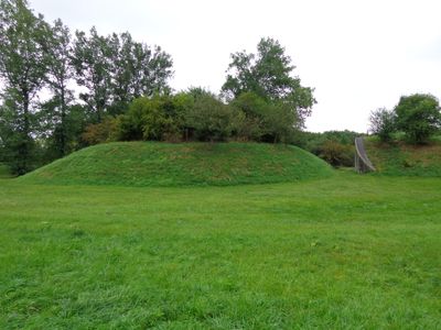
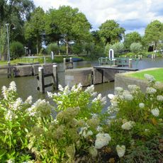
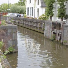
Nieuwersluis Fort, was built 1815 and is part of the New Dutch Waterline to protect

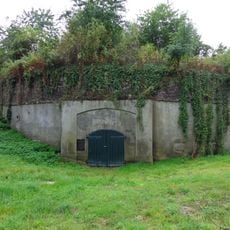
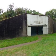
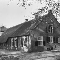
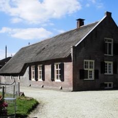
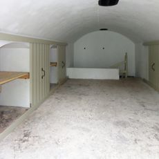
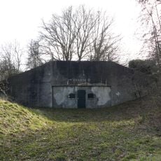
Nieuwersluis Fort is a fortification in Stichtse Vecht built between 1849 and 1851 with thick stone walls and small windows typical of its era. The structure contains interior courtyards, meeting rooms, and grassy rooftop areas, surrounded by meadows and the Vecht river.

The fort was built between 1849 and 1851 as part of the New Dutch Waterline to protect nearby locks and waterways. Later it served as a command post during the Cold War, extending its military function across more than a century of the region's defense history.

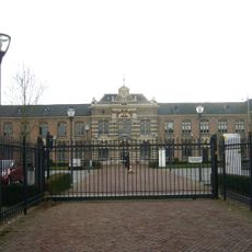
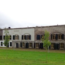
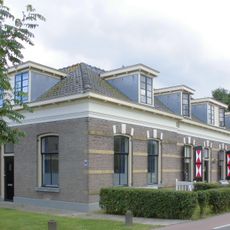
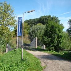
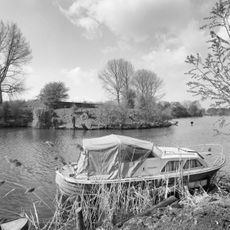
The fort takes its name from the nearby water locks and its position on the Vecht river. Today it serves as a gathering place where visitors experience how the site blends its military past with contemporary use as a space for meeting and socializing.

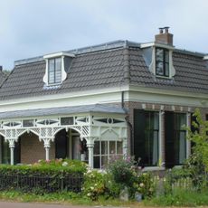
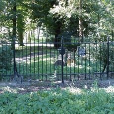
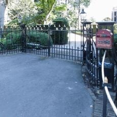
The fort is accessible from Wednesday to Sunday and offers ample parking for cars and bicycles on the grounds. Visitors find cafe facilities, meeting rooms, and well-maintained paths for exploring the site and surrounding landscape.

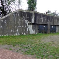
The fort was originally accompanied by a separate tower built later alongside the main structure to provide additional defense. This secondary fortification offers visitors insight into the layered defensive strategy employed to protect the waterways.

The community of curious travelers

AroundUs brings together thousands of curated places, local tips, and hidden gems, enriched daily by 60,000 contributors worldwide.

Start exploring
Location
Part of
NHW-Fort Nieuwersluis, Dutch Water Line
Address
Rijksstraatweg 9 te Nieuwersluis
GPS coordinates
52.19634,5.00391
Latest update
February 9, 2026 07:40
Around this place
Rijksbeschermd gezicht Nieuwersluis
Netherlands

Rijksbeschermd gezicht Nieuwersluis

271 m
Rijksstraatweg 9 te Nieuwersluis
Netherlands

Rijksstraatweg 9 te Nieuwersluis

161 m
Koning Willem III Kazerne
Netherlands

Koning Willem III Kazerne

410 m
Rijksstraatweg 9 te Nieuwersluis
Netherlands

Rijksstraatweg 9 te Nieuwersluis

161 m
Rupelmonde
Netherlands

Rupelmonde

334 m
Rupelmonde, Nieuwersluis
Netherlands

Rupelmonde, Nieuwersluis

293 m
Fort Nieuwersluis: Bomvrije kazerne (Gebouw B)
Netherlands

Fort Nieuwersluis: Bomvrije kazerne (Gebouw B)

7 m
Rijksstraatweg 7, Nieuwersluis
Netherlands

Rijksstraatweg 7, Nieuwersluis

373 m
Woonhuis
Netherlands

Woonhuis

306 m
Koning Willem III Kazerne: Onderofficierswoningen (Gebouw H)
Netherlands

Koning Willem III Kazerne: Onderofficierswoningen (Gebouw H)

410 m
Rupelmonde: Tuinmuur
Netherlands

Rupelmonde: Tuinmuur

365 m
Fort Nieuwersluis
Netherlands

Fort Nieuwersluis

12 m
Sterreschans: Boerderij in overpark
Netherlands

Sterreschans: Boerderij in overpark

373 m
Pand met lijstgevel met rijk versierde ingangspartij met de wapens van utrecht en amsterdam en twee leeuwen
Netherlands

Pand met lijstgevel met rijk versierde ingangspartij met de wapens van utrecht en amsterdam en twee leeuwen

254 m
Rijksstraatweg 9 te Nieuwersluis
Netherlands

Rijksstraatweg 9 te Nieuwersluis

161 m
Houten loods, quasi natuursteen geblokt
Netherlands

Houten loods, quasi natuursteen geblokt

279 m
Koning Willem III Kazerne: Pupillenschool (Gebouw C)
Netherlands

Koning Willem III Kazerne: Pupillenschool (Gebouw C)

410 m
Rupelmonde: Koetshuis
Netherlands

Rupelmonde: Koetshuis

235 m
Koning Willem III Kazerne: Directeurswoning (Gebouw F)
Netherlands

Koning Willem III Kazerne: Directeurswoning (Gebouw F)

362 m
Damsluis
Netherlands

Damsluis

333 m
Fort Nieuwersluis: Remise NW (Gebouw C)
Netherlands

Fort Nieuwersluis: Remise NW (Gebouw C)

7 m
Schutsluis in nieuwe wetering, voorzien van houten puntdeuren
Netherlands

Schutsluis in nieuwe wetering, voorzien van houten puntdeuren

214 m
Rijksstraatweg 9 te Nieuwersluis
Netherlands

Rijksstraatweg 9 te Nieuwersluis

161 m
Rijksstraatweg 31, Nieuwersluis
Netherlands

Rijksstraatweg 31, Nieuwersluis

212 m
Rijksstraatweg 9 te Nieuwersluis
Netherlands

Rijksstraatweg 9 te Nieuwersluis

161 m
Fort Nieuwersluis: Dubbele Remise O (Gebouw E)
Netherlands

Fort Nieuwersluis: Dubbele Remise O (Gebouw E)

7 m
Sterreschans: Toegangshek overpark tegenover toegangshek oprit koetshuis
Netherlands

Sterreschans: Toegangshek overpark tegenover toegangshek oprit koetshuis

386 m
Rupelmonde: Toegangshek
Netherlands

Rupelmonde: Toegangshek

325 m
Show the full map
Reviews
Share your experience

No review yet

Discussions
Start a discussion...

No discussion yet

« Nieuwersluis Fort - was built 1815 and is part of the New Dutch Waterline to protect » is provided by Around Us (aroundus.com). Images and texts are derived from Wikimedia project under a Creative Commons license. You are allowed to copy, distribute, and modify copies of this page, under the conditions set by the license, as long as this note is clearly visible.

Discover hidden gems everywhere you go!

From secret cafés to breathtaking viewpoints, skip the crowded tourist spots and find places that match your style. Our app makes it easy with voice search, smart filtering, route optimization, and insider tips from travelers worldwide. Download now for the complete mobile experience.

Around Us App Screenshot

A unique approach to discovering new places

Le Figaro

All the places worth exploring

France Info

A tailor-made excursion in just a few clicks

20 Minutes

Around Us
Travel Guide & Maps
Download

Send to your phone

QR Code
1

Open the camera app on your mobile.

2

Point at the QR code with your camera. A notification will appear.

3

Tap the notification to open the link.