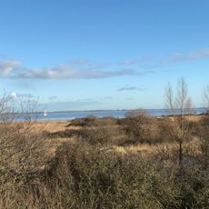
Slikken van Flakkee, Nature reserve on Goeree-Overflakkee island, Netherlands.
Slikken van Flakkee is a nature reserve on Goeree-Overflakkee island that covers wetlands, tidal flats, and extensive grasslands. The area supports many bird species and contains several distinct habitats within its boundaries.
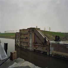
The landscape changed fundamentally after the Delta Works were completed in 1970, transforming the area from a natural tidal zone into a managed water system. This infrastructure allowed new ecological patterns to develop and shaped how the land is used today.
Local people maintain traditional land management through controlled grazing with Fjord horses and Heck cattle in specific zones. These practices shape how the area looks and functions today.
The area can be explored via three marked walking trails that connect the northern, middle, and southern sections with various viewing points. Visitors should wear weatherproof clothing and sturdy shoes, as the ground can be muddy or wet depending on the season.
The northern section contains a natural forest that developed on its own over several decades without human intervention. This forest demonstrates how nature can recover and thrive in this coastal setting when left largely undisturbed.
The community of curious travelers
AroundUs brings together thousands of curated places, local tips, and hidden gems, enriched daily by 60,000 contributors worldwide.