Indre og ytre by i Oslo, Administrative districts in Oslo, Norway
Indre og ytre by i Oslo refers to 15 administrative districts divided into two zones: the inner city with dense housing blocks and compact urban design, and the outer areas with more spread-out residential neighborhoods. Together these divisions create the administrative structure of the city, with each district maintaining distinct local characteristics.
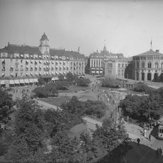
Inner Oslo originated from the former boundaries of Christiania, a fortress settlement established in the 17th century. The current division between inner and outer districts was created during the 1948 city expansion when the Aker municipality was incorporated into Oslo.
The inner districts are where younger people gather in cafes and social spaces, creating a lively mix of different communities. The outer neighborhoods feel more family-oriented, with parks and schools forming the center of daily life for residents.
The inner districts are walkable and easy to explore on foot, while the outer neighborhoods are best reached by public transport. Both zones remain accessible throughout the year, though each season brings different impressions of the city.
The boundary between inner and outer districts is not immediately obvious when walking through the city, as neighborhoods blend together rather than showing clear dividing lines. Yet these invisible administrative divisions meaningfully shape how residents describe their surroundings and sense of belonging.
The community of curious travelers
AroundUs brings together thousands of curated places, local tips, and hidden gems, enriched daily by 60,000 contributors worldwide.